
Summer research program for undergrads & K-12 teachers
New $465,000 NSF grant to Citizen Science GIS at UCF Offers Funded, Virtual Summer Research Experiences for U.S. Undergraduates and K-12 Teachers
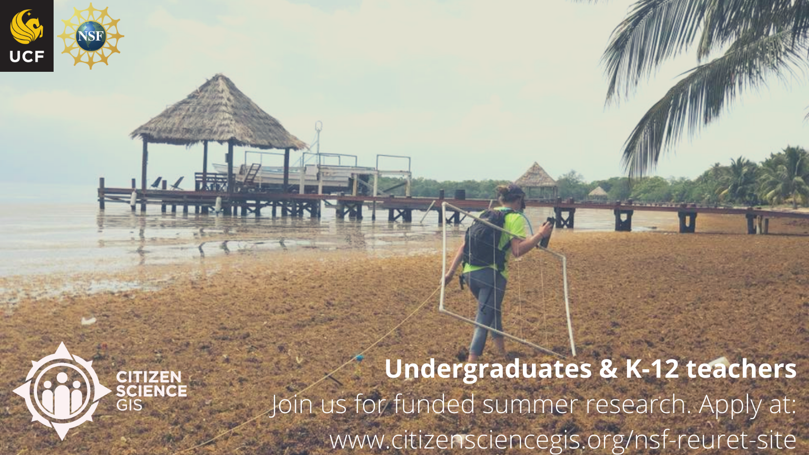
Citizen Science GIS NSF REU/RET Site Overview: This summer virtually through Citizen Science GIS at University of Central Florida, we are pleased to host the fifth year of our National Science Foundation Research Experiences for Undergraduates & Teachers (REU/RET) Site “Preparing the Next Generation of Scholars through Community GIS and Citizen Science.” Our virtual program (due to COVID) offers fully funded summer research experiences for eight undergraduate students and two K-12 teachers. Participants will also be invited to a fully funded ten-day fieldwork experience to Belize in early 2022 as COVID conditions improve.
“With this new $465,000 grant, NSF continues to invest in the importance of community-focused science. We are thrilled to be hosting an REU and RET Site (as we have since 2016) and we are excited to work across disciplines, locations, and countries to showcase the immense power of everyday, extraordinary people in science. Our commitment to using maps, apps, and drones through Citizen Science GIS remains strong, and we look forward to the collaborative work being strengthened even more with a new cohort of change-makers,” - Timothy L. Hawthorne REU/RET PI and Citizen Science GIS Founding Research Director.
Program Dates: Virtual from June 1-July 9, 2021. Belize fieldwork, early 2022.
Application process: Priority application deadline is Friday, April 9th at: https://www.citizensciencegis.org/nsf-reuret-site.
3/31 Zoom session: Join us from 4-5 pm EST on Zoom to ask questions/learn more about the program with our REU/RET faculty. Register at: https://tinyurl.com/52zjdvzk.
Eligibility requirements: As an NSF-funded program, open to all U.S. citizens and permanent residents. We are interdisciplinary emphasizing community geography, community GIS, and citizen science through mixed methods, including sketch mapping, mobile mapping applications, focus groups, in-depth interviews, GIS, spatial analysis, and drones. Since 2016, over 70% of participants have been from underrepresented groups in STEM, and from several disciplines including geography, GIS, environmental studies, sociology, anthropology, biology, chemistry, political science, business/economics, education, and more.
Research directions: Work with community partners and mentors from University of Central Florida, George Mason University, University of Belize, Georgia State University, and The Smithsonian National Museum of Natural History’s Caribbean Coral Reef Ecosystems Program. Research Direction 1: Leveraging community geography & GIS to map disparities in flooding. Research Direction 2: Leveraging community geography & GIS to reduce waste and prevent marine debris.
Funding: $4200 research stipend, $750 for post-REU conference travel or industry visits, research methods books, technology support, and all expenses covered for 2022 Belize fieldwork.
Questions directed to:
· Dr. Timothy Hawthorne: Principal Investigator, Associate Professor of Geographic Information Systems, Director of Citizen Science GIS at University of Central Florida. Email: timothy.hawthorne@ucf.edu
· Dr. Hannah Torres: Co-Principal Investigator, Assistant Director of Research Operations Center for Resilient and Sustainable Communities at George Mason University. Email: htorres3@gmu.edu