A Flood of Nerves and a Wave of Support: Presenting at the 2022 Esri #OWCForum
By Halley Spencer, Laurel Sparks, Valerie Melendez, and Yasmin Aden

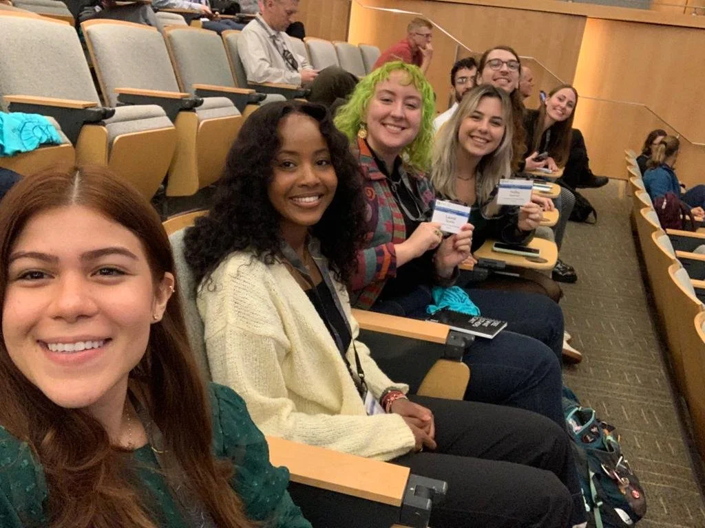
It’s finally presentation day for our Debris and Flood teams as we enter day two of the 2022 Esri Oceans, Weather, and Climate GIS Forum!
With excitement and nerves bubbling, we began with the day's first Technical Plenary Session where we learned about new data, tools, and applications Esri has to offer. We heard from amazing Esri GIS specialists, including Keith VanGraafeiland, Mark Gilbert, Abigail Fitzgibbon, Craig McCabe, and Emily Meriam. We were blown away by Emily’s creation of a map that tracks wildfires in the US in real-time. It was so inspiring to see how these impressive technical skills can create visualizations of important issues that everyone can use and understand.
In the second Technical Plenary Session, GIS specialists from academia, government, and private sectors showcased their applications of GIS for climate resilience, coastal hazards, and conservation. We heard from Megan Fraser (NOAA FKNMS / NMSF), George McLeod (Old Dominion University), and Jim Fox and Kim Rhodes (Fern Leaf). It was both sobering and motivating to see how flooding will affect major cities in the country and how GIS can help solve this issue.
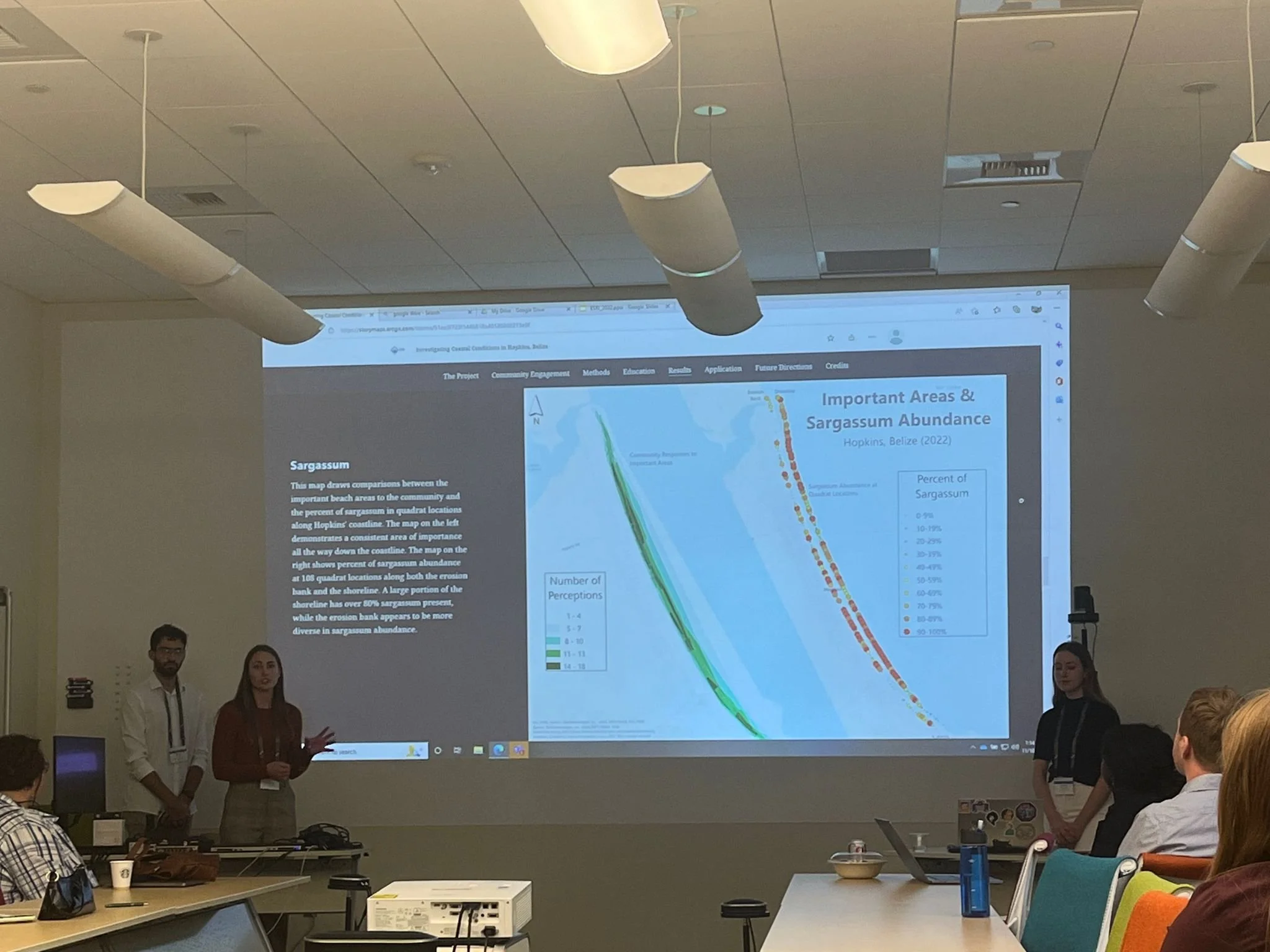
Our anticipation grew as we prepared for the first Citizen Science GIS presentation of the day. The Marine Debris team members presented their investigation on Coastal Conditions in Hopkins Village, Belize.
The team (Shaun Baughman, Valerie Melendez, Simone Schneider, and Micah Ortiz) first discussed their positive experiences with community engagement and education in Hopkins. They also emphasized the data collection and GIS analysis of marine debris hotspots and areas of community concern. It was the team’s first experience presenting their scientific research at a conference of this caliber, but they were welcomed with tremendous support. Following their presentation, we also heard from Rochelle Wigley (Map the Gaps) and Alex Driedger (ProtectedSeas) who provided insightful information regarding the influence of community on their marine conservation organizations.
After the Debris Team’s presentation, we had an amazing discussion with Carl Nettleton (Founder, OpenOceans Global). Carl was interested in including Hopkins Village, Belize in the interactive map their organization is creating to locate the world’s trash. He is excited to highlight the work of Citizen Science GIS on their platform and hopefully collaborate in our future work to mitigate marine debris in Hopkins Village.
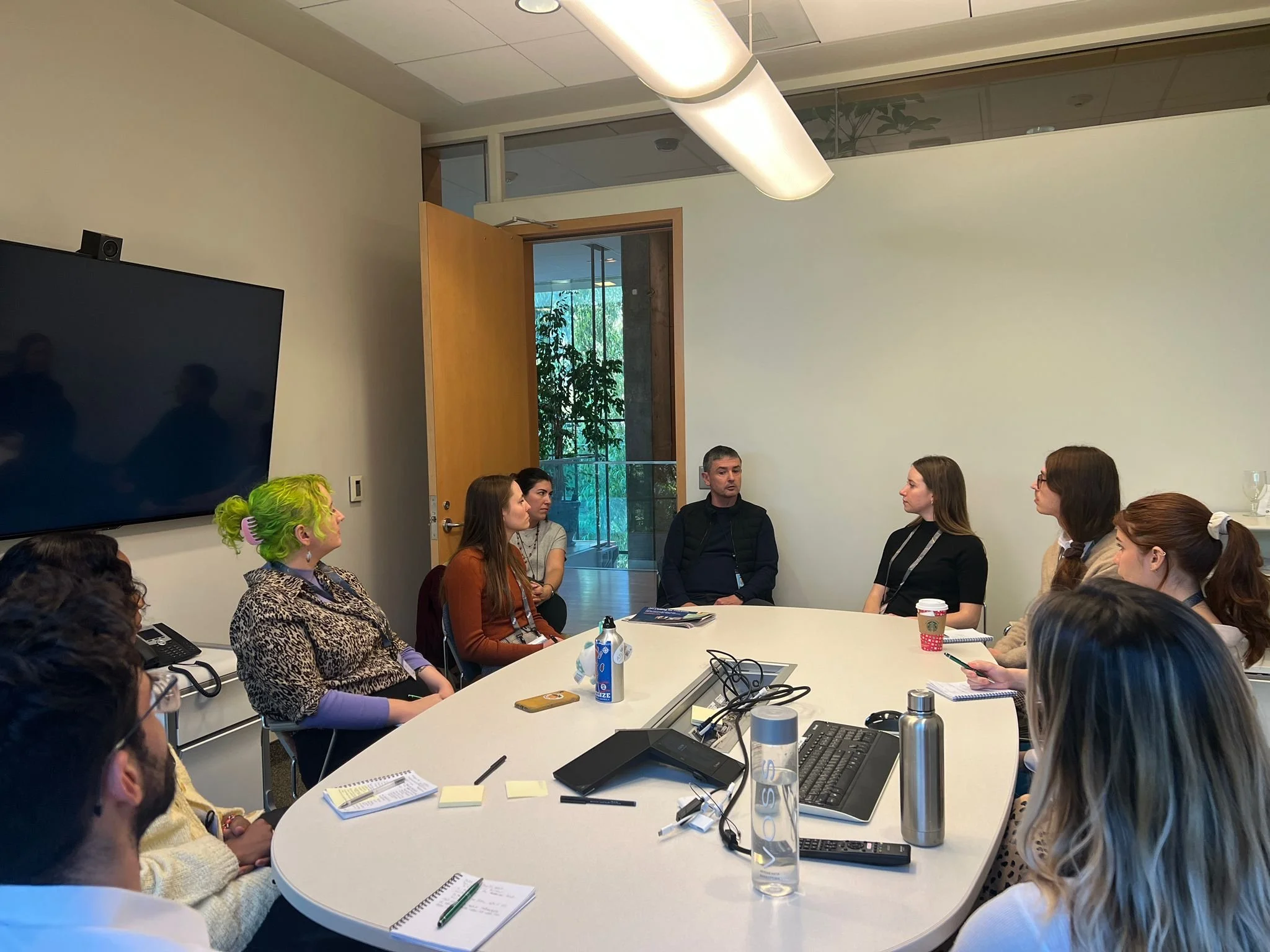
In between the Marine Debris team and Flood team presentations, we had the wonderful opportunity to sit down with Marcella Cavallaro and Nigel Brown from Esri’s Digital Sales department.
We heard about their day-to-day responsibilities and valuable insight into what qualities they look for in new hires for their team. The meeting was full of valuable information, laughs, and passion about furthering both Esri’s mission and individual development.
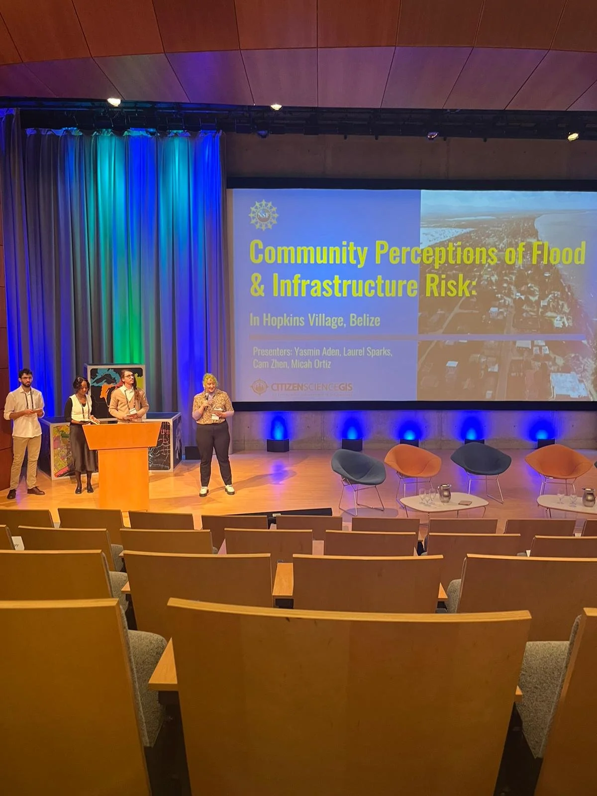
The Flood team members (Yasmin Aden, Laurel Sparks, Cam Zhen, Micah Ortiz) prepared to help close out the forum in the last session of the day which focused on Aligning Ocean Community and Processes.
The Flood team was amongst some fantastic speakers including John Bright (Cardinal Point Captains, Inc) and William Robberson (Kamilo). They discussed their research on Community Perceptions of Flood and Infrastructure Risk; highlighting the participatory GIS (PGIS) methods and quantitative data collection systems they designed to address key community concerns about flood risk in Hopkins Village. The presentation emphasized the Flood team’s research framework which included: Continuity, Equity, Education, and Resiliency. After the presentation, the team had a great open dialogue with the audience where they discussed important topics such as indigenous building practices, the growing acceptance of PGIS methods, and additional ways to extend their framework of future research efforts.
After the flood team finished their presentation, the forum closed off with a panel discussion. The closing session was an especially critical point of reflection for our team as the only university student group presenting our research.
As early career researchers, the energy the audience put forth in their commitment to continue building on the momentum from the conference was inspiring. The opportunity to present our research in front of such esteemed scientists and field experts left us feeling more connected and in solidarity with the broader scientific community.
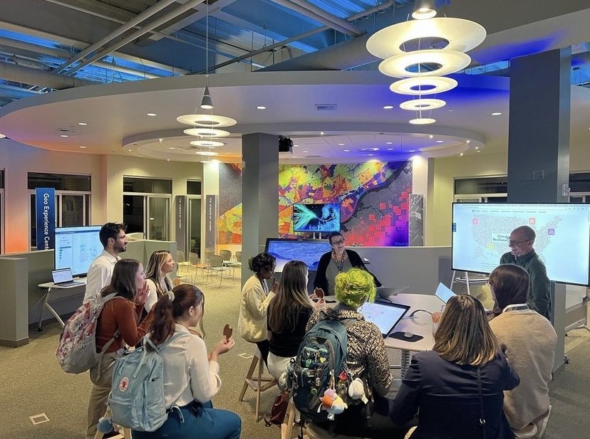
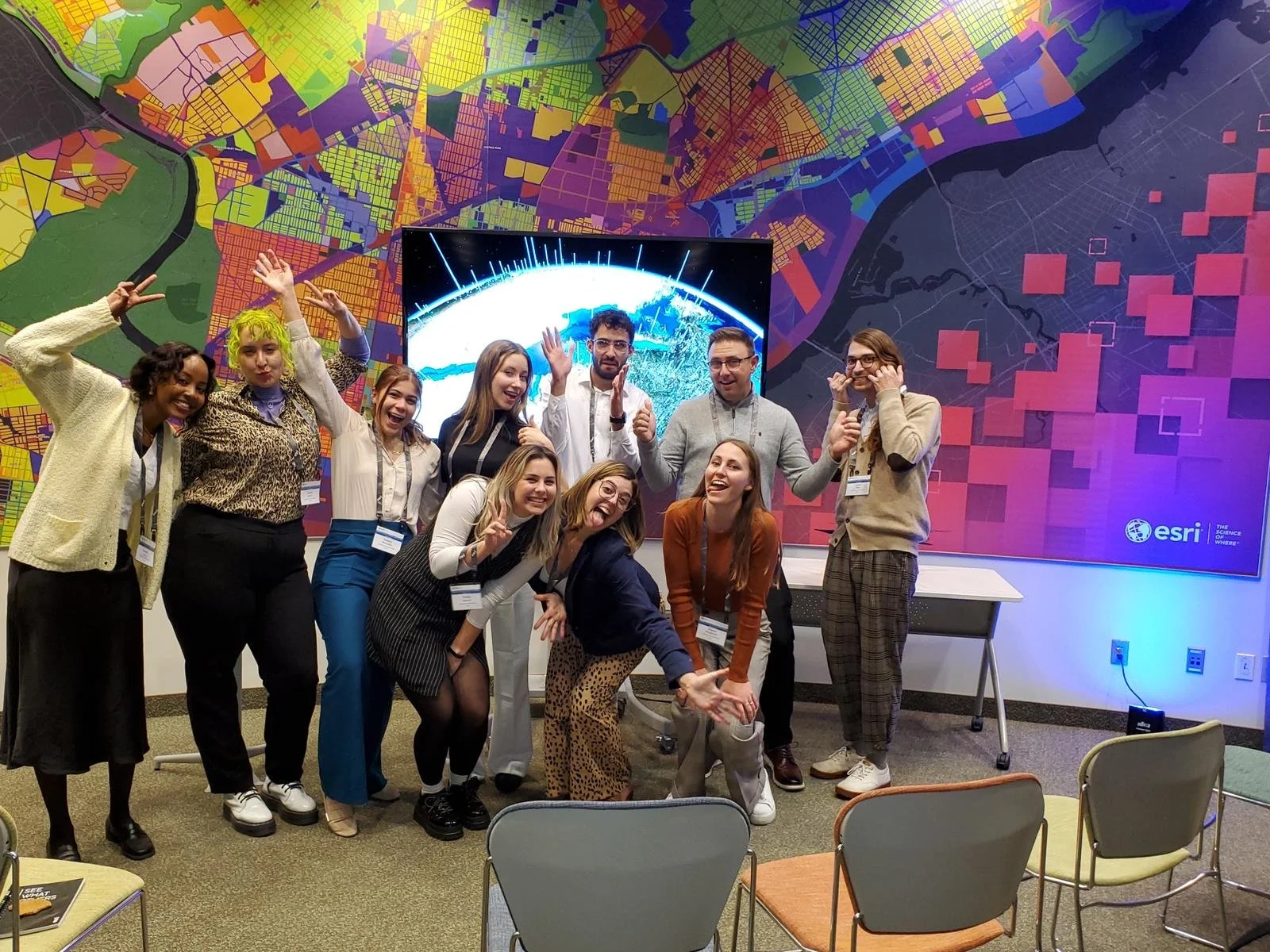
Once the forum officially ended, the Citizen Science GIS team was given an amazing opportunity to visit the Esri Applications Prototype Lab (APL). We saw an array of demonstrations of amazing and important tools Esri is currently developing, led by Thomas Emge (Manger; APL). It was a fantastic and inspiring way to close out the forum for the Citizen Science GIS team!
As the only university student team of presenters, we are overwhelmed by the amazing response to our presentations by industry leaders. As developing researchers, we are so thankful for the support provided by the team at Esri and the opportunity to be a part of such a conductive, collaborative forum. We are especially thankful for the tools and products Esri has developed; without which our research efforts would have never been possible!