
Lego City At-Home Mapping Lesson and Challenge

My kids and I are practicing social distancing. My professor job allows me to safely work from home right now. And my kids are safely schooling from home. We're finding ways to learn together!
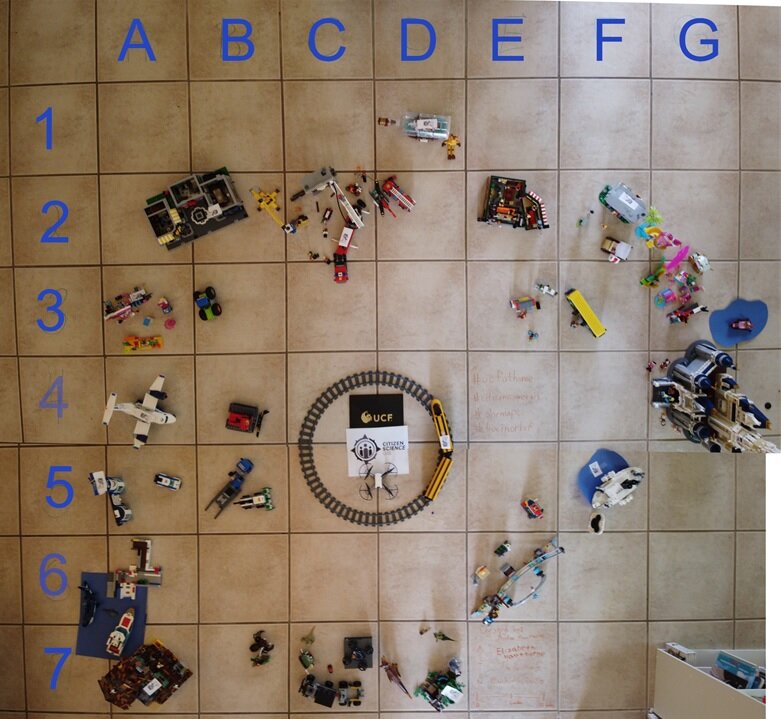
So, we thought we'd share with you our Lego City At-Home Mapping Activity. We flew a mini-drone over our Lego City in our living room to teach kids and families around the globe about map basics, including map grids and scale bars.
Check out the cool drone fly-over shot of our Lego City. And then we challenge you to listen to the 17 minute presentation, complete the 9 question worksheet, and create a map model at home and share on our Facebook page. See the details below. Happy learning. It will be maptastic. Have fun.

Listen to the 17 minute presentation on youtube: Check out our audio-guided presentation and lesson about map grids and scale bars in our Lego City at-home map activity.
Alternatively, you can download the full power point presentation here.

Complete the worksheet: Once you follow along with the presentation, try to answer our 9 questions in the Worksheet using the Lego City Map.
Download the worksheet as a Word document here.
Download the worksheet as a PDF here.

Share your at-home Lego City or toy map models at www.facebook.com/citizensciencegis. We challenge you to make a Lego City Map (or a map made of toys in your house). Then share your map photos or videos on our Facebook page to inspire others around the globe to engage in at-home mapping.


