
Divine Mercy Catholic Academy - Our Last Maps, Apps and Drones Tour Stop!
Written by Undergraduate Sara Peluso (Environmental Major)Our final Maps, Apps and Drones Tour stop for the 2017-2018 school years was a special day for us! On May 10th our team traveled to Divine Mercy Catholic Academy in Merritt Island to unveil our augmented reality sandbox! The school hosted a Geospatial and Conservation Day, where our drone and sandbox were featured activities. The students cycled through the activities on the Geospatial and Conservation day agenda by grade level, so we had about 20 kids for each half hour cycle.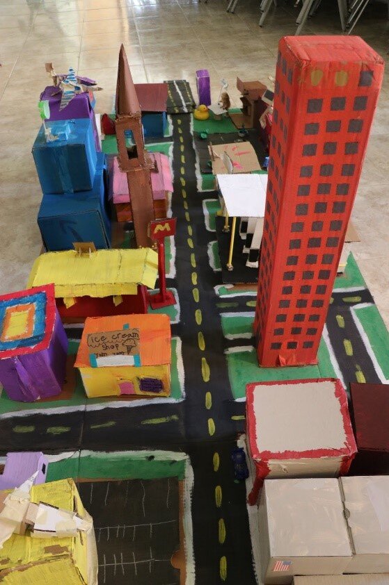 The drone activity was set in the auditorium, where two fabulous models were set up. The attention to detail on these models was absolutely fantastic, the students included a Dunkin Donuts, Target, a Chik- fil- a (with a menu!), skyscrapers, and even a laboratory in a tree house. The amount of work put into these models was truly appreciated. After Lain led our Maps, Apps and Drones presentation, the students broke off into equal sized groups to fly over the two models. Many of these students had flown drones before, and a few even owned their own. The students were asked about how the models would be affected after a disaster (such as a hurricane) was to strike, and students responded remarkably well with answers regarding how the buildings and the people in the communities would be affected.
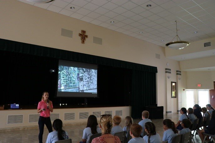 In the social room, adjacent to the auditorium, Nick had set up our augmented reality sandbox for its first ever demonstration! As students entered the room they gathered around the sandbox as Nick and Sara built mountains and created bodies of water, then simulated a landslide to show how the box could be utilized for disaster management and urban planning.
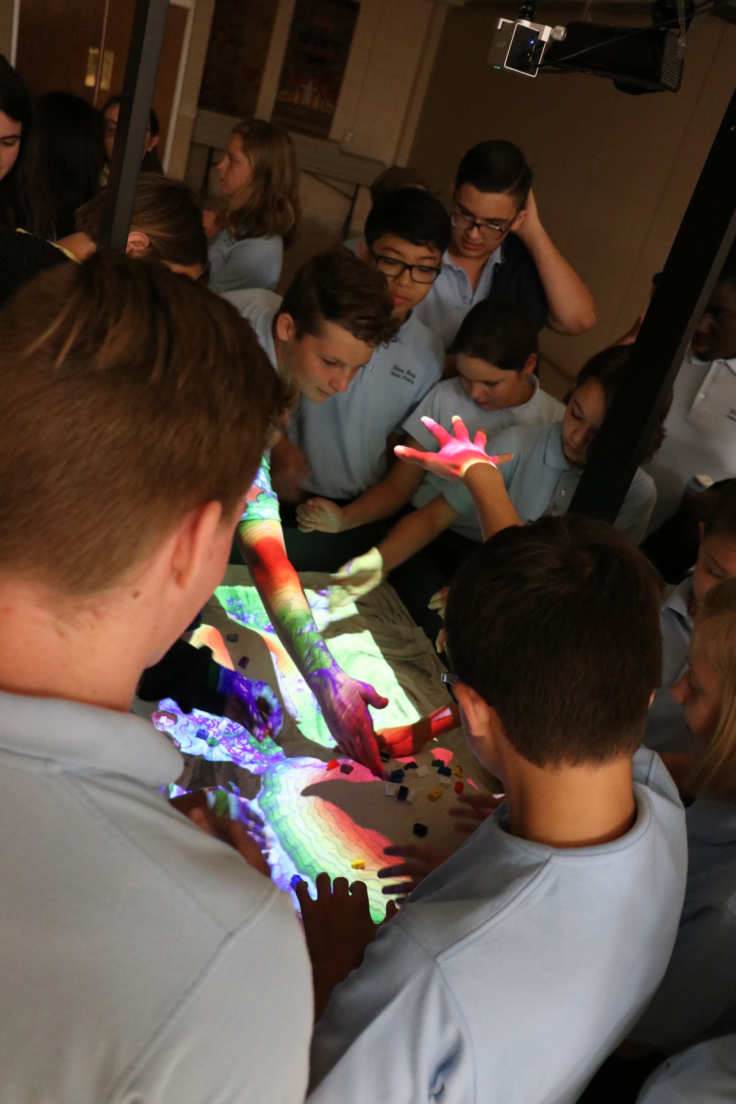 Students were then broken up into groups of five, where they had the opportunity to create their own landforms to see how flooding and landslides would affect their communities. They were introduced to the concept of contour lines, and they were able to explain to us why rainfall would be more likely to affect communities situated in valleys and below the mountain ranges because water flows downward. It was really awesome when a group of students decided they wanted to create a plateau, rather than just some mountains and valleys. The students were also extremely interested in the design of the sandbox and many asked how much it was for us to construct, mainly because they wanted to get one of their own.
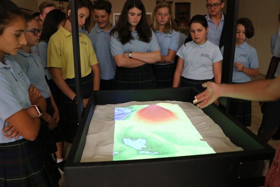 Overall, the day was a massive success. It was a truly amazing experience to see the students and teachers just as interested in our work as we are. We would like to take this time to make a special shout out to all of the amazing kids and teachers we visited this year on the Maps, Apps and Drones tour for constantly reminding us why we love everything we do! Have a great summer everyone and we’ll see you next year!