
Citizen Science GIS Staff Spotlight, Lain Graham

Lain Graham is a Ph.D. Candidate studying Sociology and GIS at the University of Central Florida. She earned her M.A. in Bioarchaeology from Georgia State University in 2014 and maintains status as a registered professional archaeologist.Lain writes:As a lifelong student of human behavior and biology, I have been intrigued by human/environmental interactions; why people do the things that they do, how these decisions are influenced by social forces, and by the built and natural environment? Finally, what are outcomes that result from these individual or group level developments?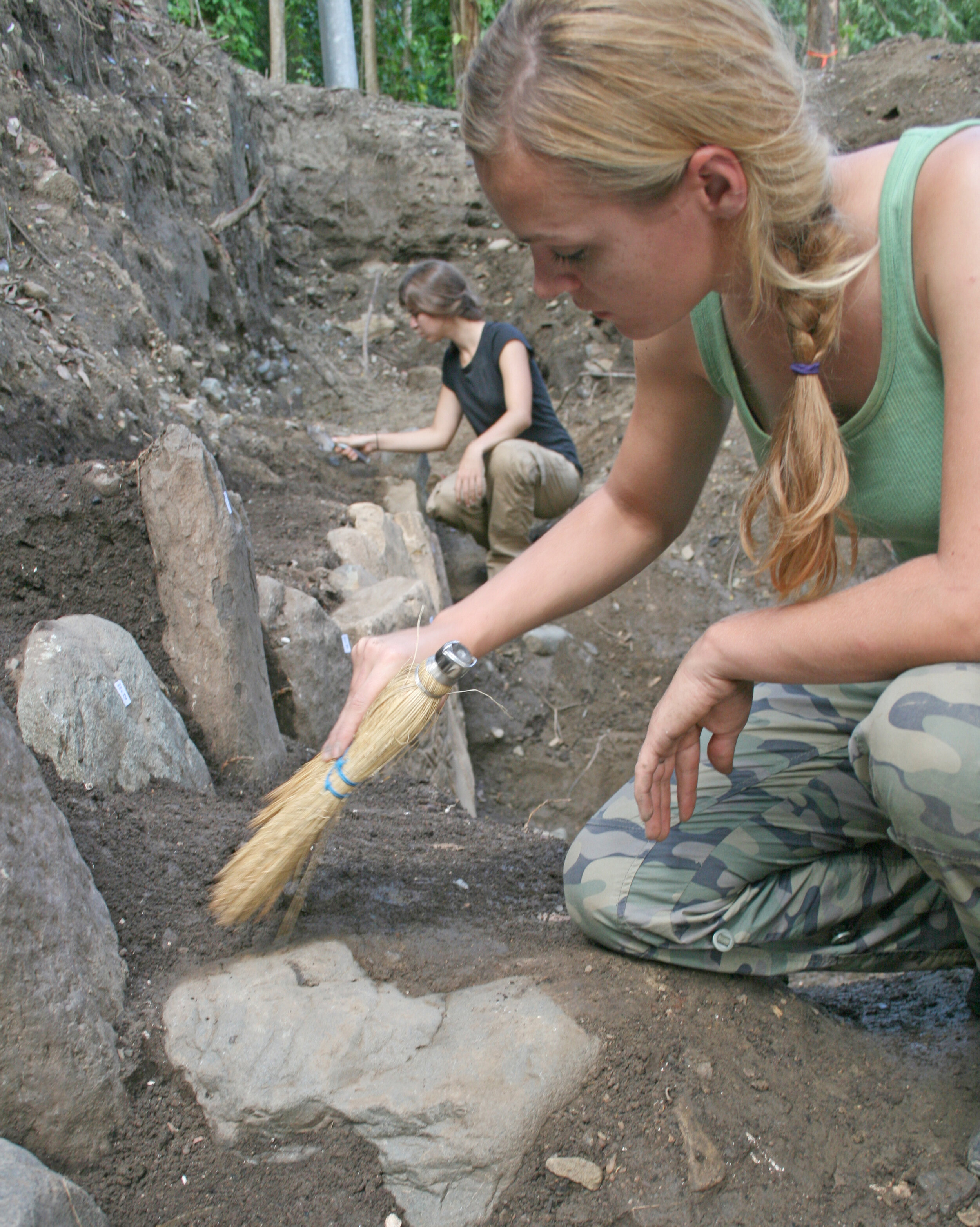 Geographic information systems (GIS) have proven to be incredibly powerful and versatile tool which I have utilized in different ways throughout my career. As a professional archaeologist, GIS facilitates excavation planning, guides our route and provides a platform for analysis.
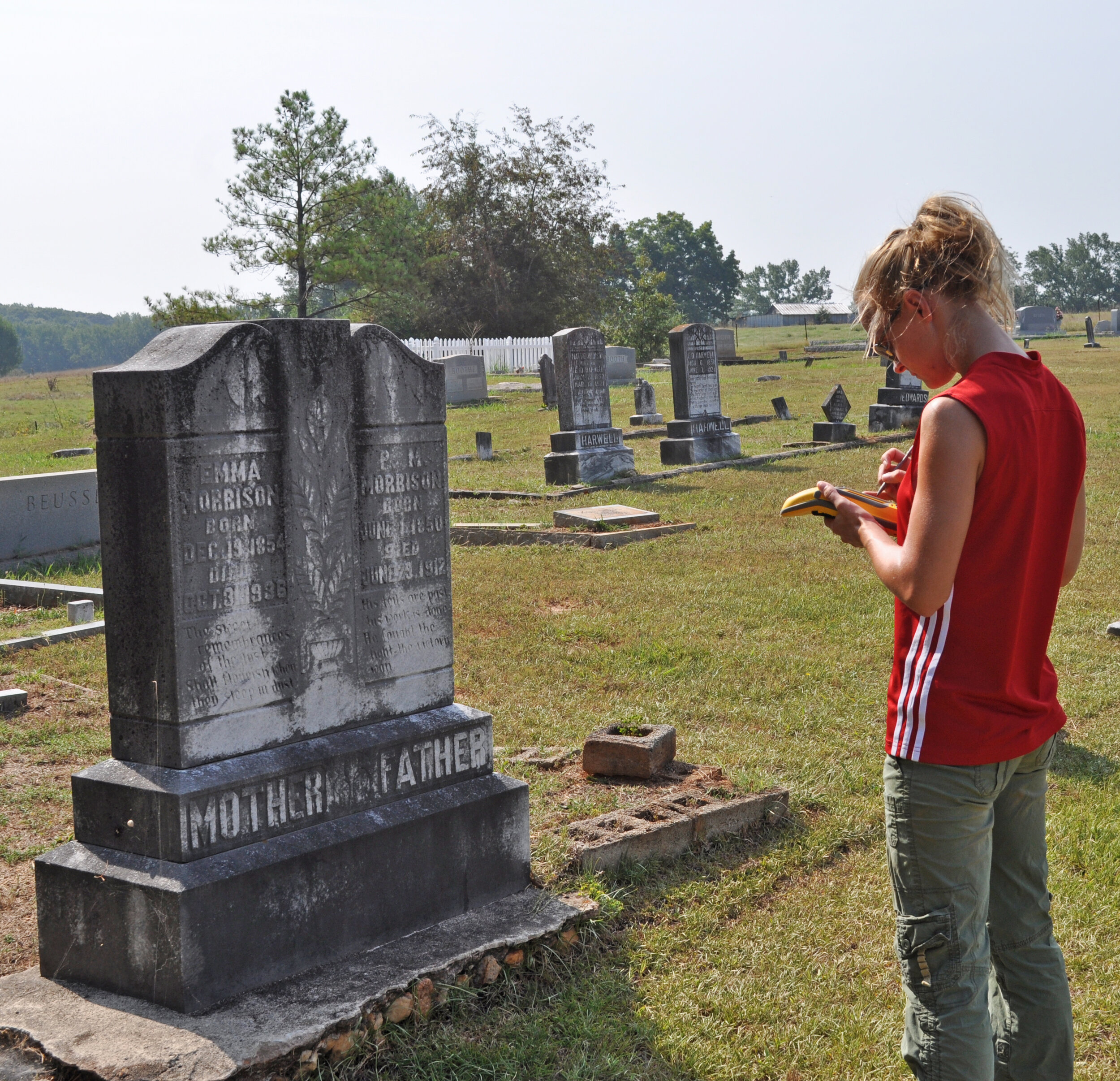 The collection of precise measurements allows us to conceptualize stratigraphic layers spanning time and space, displaying levels of occupation through the recordation of material remains and soil changes. It is through the analysis of these geospatial data that relationships emerge from which we can measure change over time, providing insights into cultural and technological diffusion, migration and innovation just to name a few.
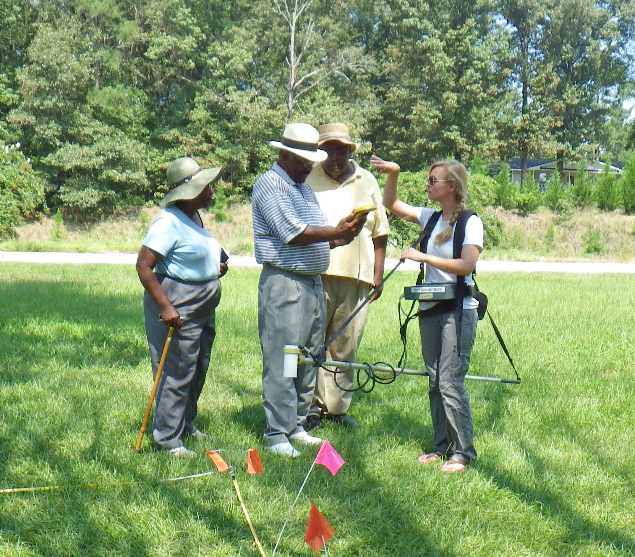
 GIS can also help us avoid excavation all together, geophysical survey technologies allow us to see through the soil without disturbing it, identifying areas that warrant further investigation or signal avoidance. GIS applications virtually connect the past to the present, allowing researchers to share their discoveries with broader audiences in the form of interactive maps, models, and stories.
 Today my work is with modern communities, as a doctoral student of sociology. I am working with communities to collaboratively map modern problems, and to work towards an inclusive evidence-based, solution-oriented dialog. I am working on several GIS-based projects in Florida and in Belize; I am a member of our Open Reef team which is systematically drone mapping the Mesoamerican reef in Belize; I am key staff on the National Research Experiences for Undergraduates (REU) site in Belize; I manage our STEM outreach programs and I am engaged in my dissertation research, which examines human/environmental attachment through the investigation of sense of place in Hopkins Village, Belize.
 As lead staff on the National Science Foundation (NSF) Research Experiences for Undergraduates (REU) site in Belize, I mentor teams of students in community-based, cross-disciplinary research on marine debris and flooding and disaster management in the coastal community of Hopkins Village, Belize. Our team has used several data acquisition approaches using GIS; we have collected GPS enabled drone imagery to serve as baseline data in a data-scarce region, from which we have measured change over time. This imagery additionally provided a platform from which digitization has occurred, and has allowed our teams to engage in both traditional terrestrial data collection and digital sketch mapping with community members to collect perception data.
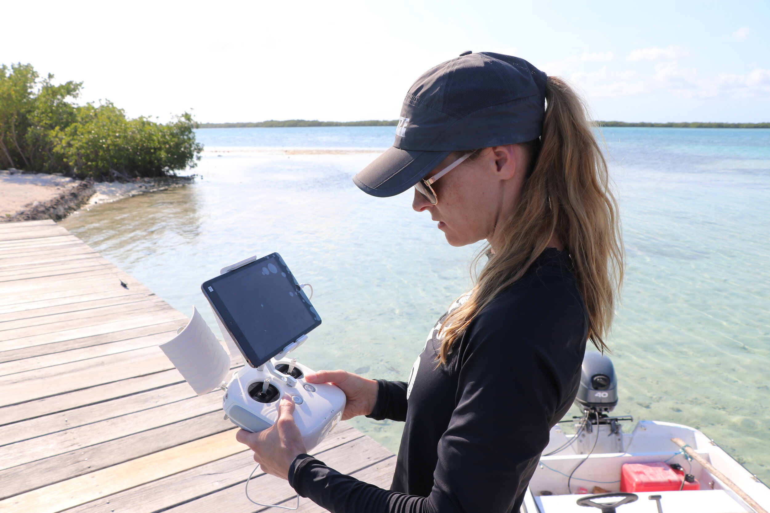 These data have the potential to connect diverse audiences, and to incorporate local knowledge through community-based collaboration, giving a voice to those often absent in decision-making processes. GIS provides communities with tangible evidence of shared perceptions and helps to identify areas of social and environmental concern. I am incredibly grateful to be involved in work that has real-world applications, that recognizes the importance of inclusion and that mentor's emergent researchers.
 My passion is in our work with our youth STEM outreach programs, the Citizen Science Youth Academy in Hopkins Village, Belize, and the Florida based, Maps, Apps and Drones Tour. This work has been salient in connecting our research to the next generation. These hands-on programs bring the many exciting applications of GIS to the classroom. I have had the honor of being a leader in this youth-focused work, which illustrates how drones are fantastic tools that can be used to connect people to one another, directed at a common goal.
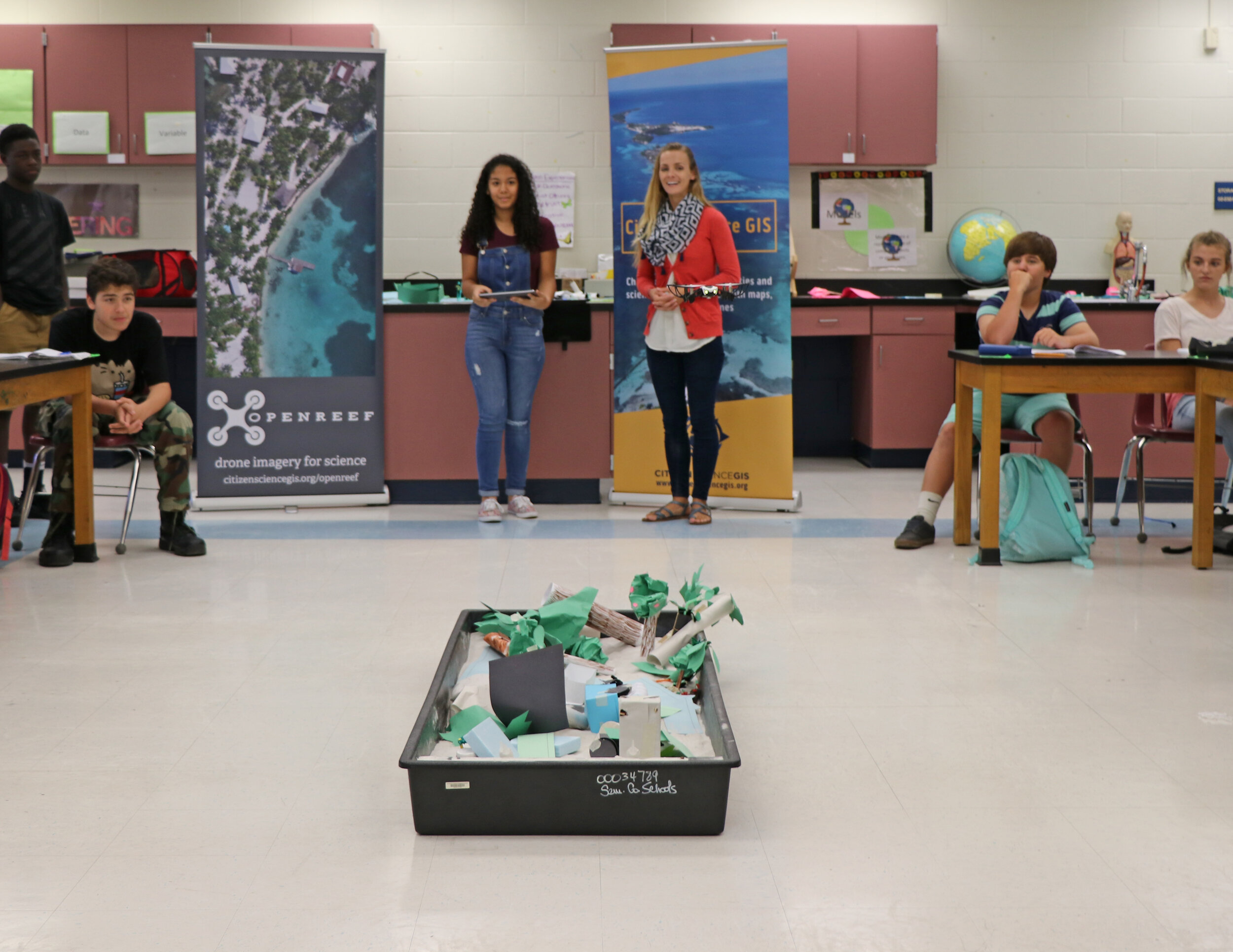 Our youth-centric programs use mini-drones to inspire and engage k-12 students in a hands-on drone mapping activity. Students remotely pilot the mini-drones over a coastal model, to collect pre-and-post disaster aerial imagery. Students work through planning, flight logistics, and analysis of the results. I am amazed how quickly even the coolest of kids get excited about this activity. It is so reaffirming to hear what they learned from the exercise and the many ways that they would use drones for good, this is such a fulfilling part of my work.
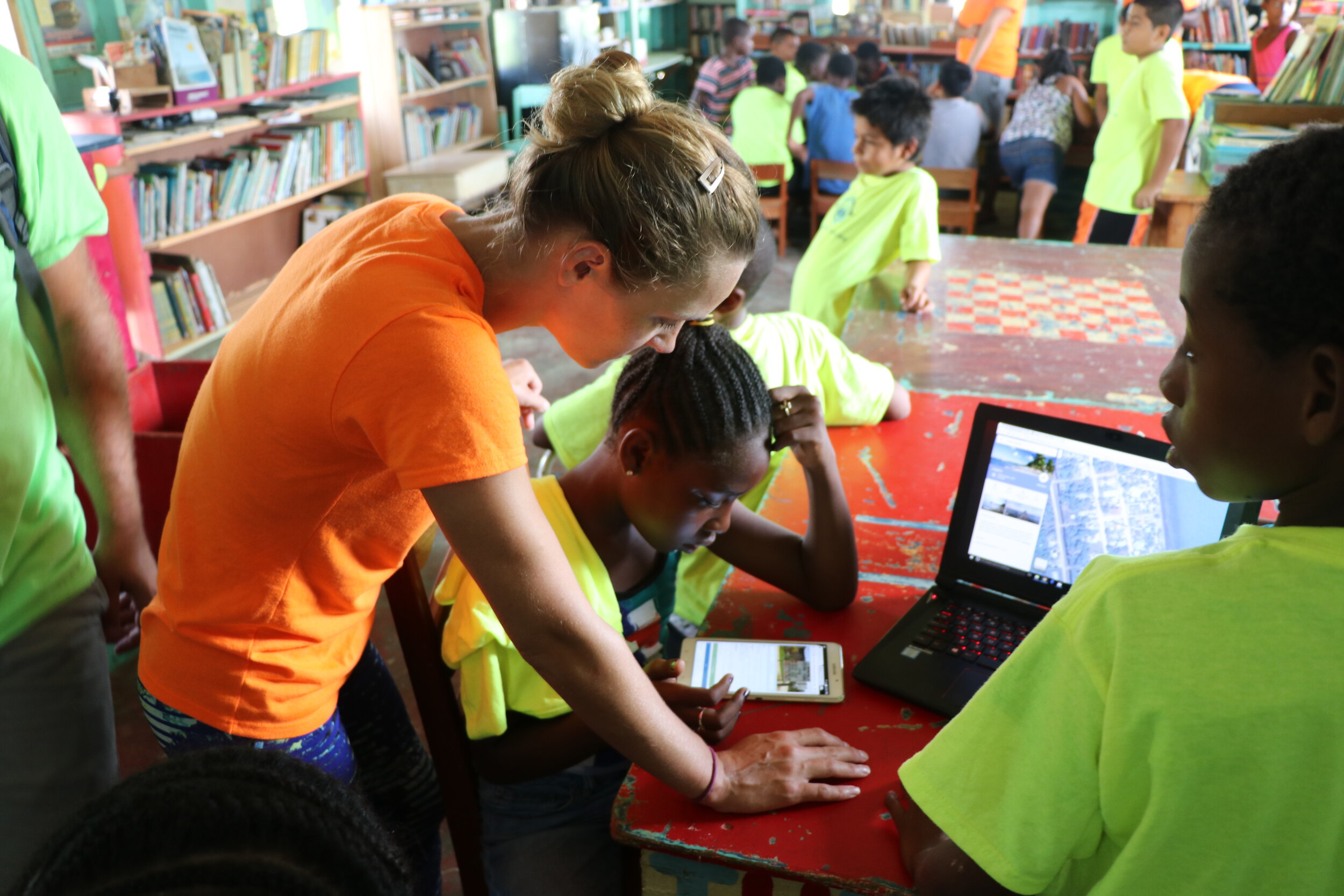
 From my undergraduate studies in classical archaeology to my graduate research in bioarchaeology, studying diet, demography, and disease, to my career as a professional archeologist in the Southeastern US, I have found that one of the more challenging aspects of work in archaeology is dependence on material remains to piece together and interpret the past. While my 7-year career in archaeology was incredibly rewarding, there were often pieces missing in our work, questions that couldn't be answered without talking to the individuals themselves. One of the benefits of my work today as a doctoral student of sociology is that I can interview participants about their relationship to their environment. These data collectively hold power beyond understanding, they have the potential to make a tangible impact.If I could offer one piece of advice to those beginning their work in the GIS realm it would be two-fold. First, GIS is just a fantastic tool, don’t lose sight of the potential that it has to connect people, these interactions will undoubtedly be reciprocal and you just might learn something from those you sought to teach. Secondly, don’t be afraid of failure, there can be a fairly steep learning curve in GIS, sometimes there won’t be a textbook, web forum or professor there to get you back on track, trial and error can be a very effective teacher.