
Renaissance Charter at Goldenrod Journey with Drones and GIS: A Maps, Apps, and Drones Tour Stop
Written by Undergraduate Carolynn Turneur (Biology major) and PhD Student Lain Graham (Sociology major) The Citizen Science GIS Team took the maps, apps, and drones tour to Renaissance Charter at Goldenrod on May 4th. We spent the beginning of our summer break from UCF with two amazing classes, one class consisting of students in the 4th-5th grade, and the second class with students in the 1st-5th grade. The students had the chance to learn how drones are used in academia research and how drone technology could be used during natural disasters, like the Volcanic Eruption in Hawaii on May 3rd, 2018. They also learned how drone technology could be integrated into their future careers. During our presentation, the students were very active in asking questions and comparing satellite imagery to drone imagery.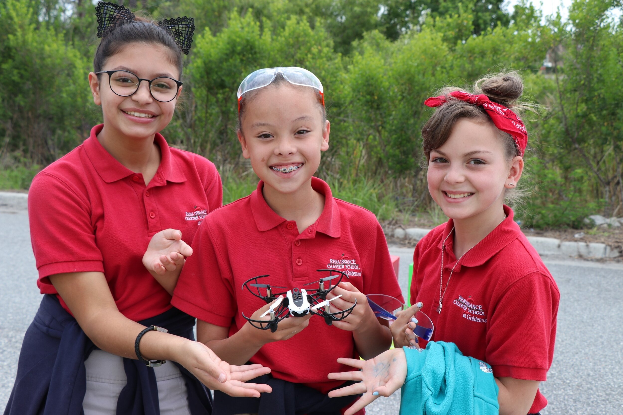 These gifted students at Renaissance Charter at Goldenrod showed off their creativity by building their own spectacular communities that they then flew over using our Parrot Mambo mini-drones. We learned about each community the students had built and had them explain their thought process behind their creativity. They were all very eager to fly, even mini-drone complications of the wind outside. Each student had the chance to fly over their community model while taking pictures with the drone before and after post-disaster. By taking pictures of there pre-and post-disaster communities they were able to be a scientific researcher for a day. They learned from this experience how researchers use imagery to analyze changes in the landscape, think through environmental and social impacts, and work through how drone imagery can help understand what changes have occurred.
 Although our time went by fast, we had a wonderful time teaching and learning from these students. We asked the kids what they wanted to be when they grew up so that we could provide examples of how GIS and drone technology could be used as a tool in their future careers. The kids had great aspirations for careers such as a “medical examiner, lawyer or supreme justice”. We would like to personally thank the students of Renaissance Charter at Goldenrod, the parents, and Ms. Jennifer Johnson for inviting us to their school to share our knowledge about GIS.
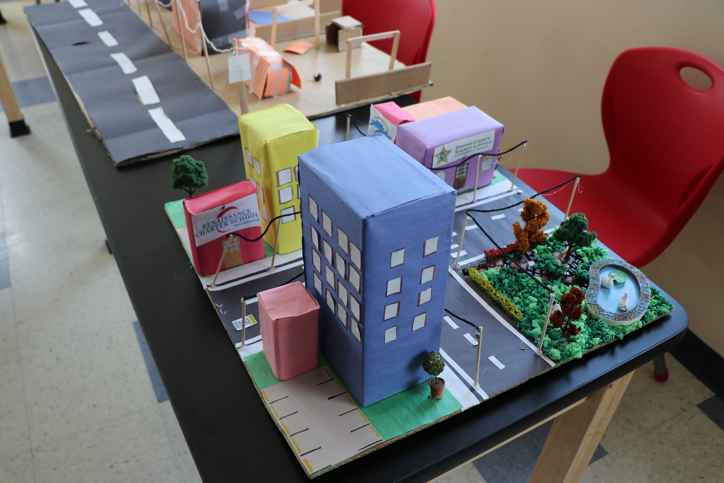
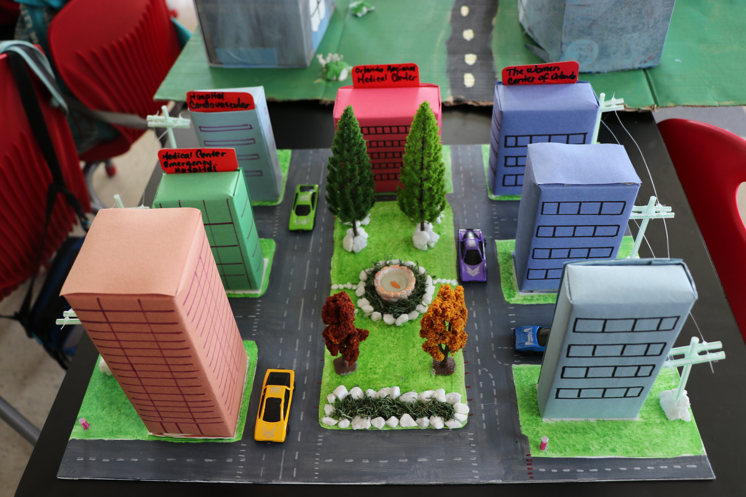
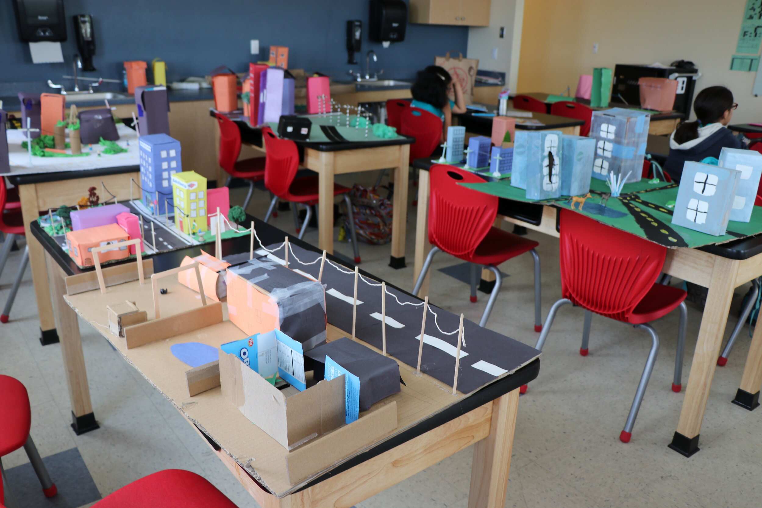
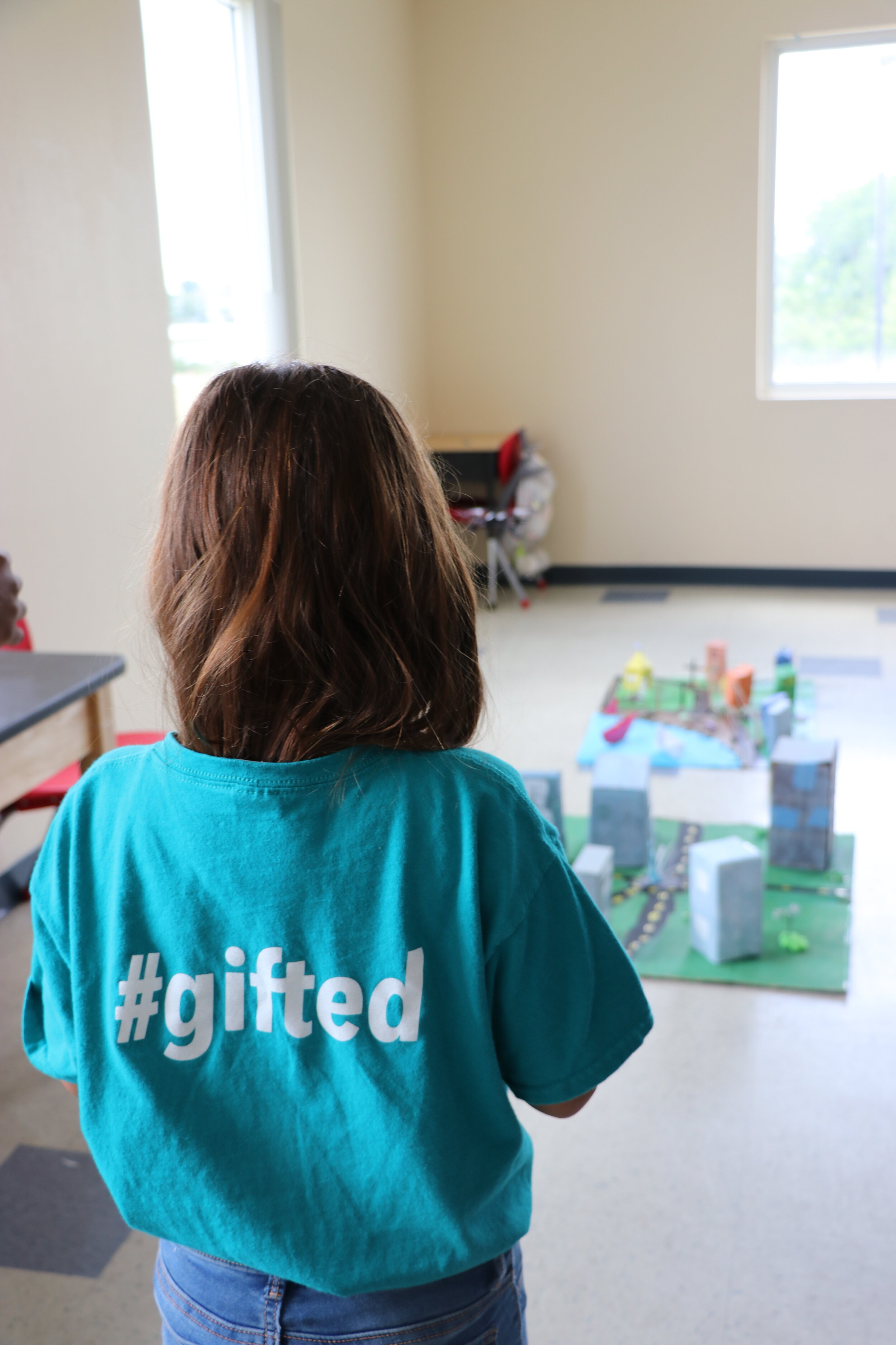 Goldenrod Gifted Teacher Jennifer Johnson stated that This activity opened up a whole new world of science to them and helped them further think about career opportunities for them to explore, which is a huge part of the standards in the continuum of learning for gifted education. We really appreciate the time and energy you took to share this branch of science and your experiences with us. I know my students will remember this activity fondly now and for a long time to come. I'm sure this activity is in each students' top five experiences of this year.We have to take a second and tip our hats to the incredible job that these kids did creating and building their models! They each put time, creativity and a lot of thought into designing and building these wonderful miniature cityscapes. There were over 20 models in total! Below are just a few, notice the attention to detail! Check out the great powerlines, roads, trees, water features and even light poles and animals!
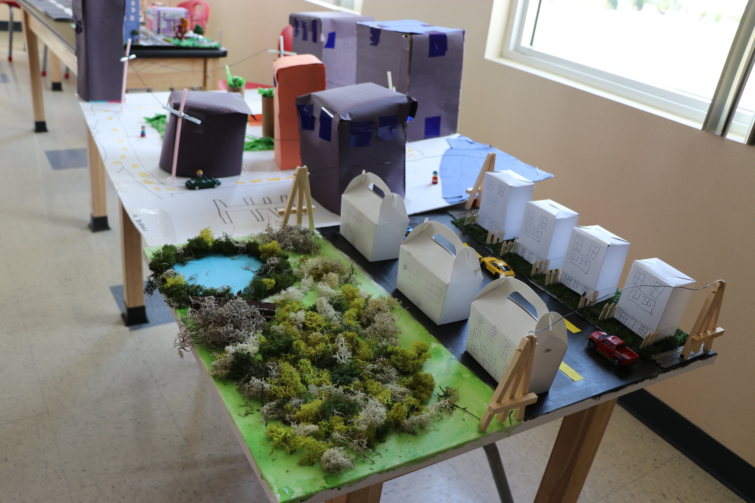
 If you are interested in having the Citizen Science GIS team bring this fun and engaging curriculum to your school, please contact us! Email us at partner@citizensciencegis.org if you want your school to experience the fun and creativity!