
Sanford Middle Schoolers Reach New Heights with Citizen Science GIS’s Maps, Apps and Drones Lesson!

On Monday September 25, with Hurricanes Harvey, Irma and Maria fresh in their minds, eighth-graders from Sanford Middle School had the chance to become drone pilots, learning how drones can be helpful in disaster planning, management, and recovery. After researchers from the University of Central Florida's Citizen Science GIS and Open Reef Projects shared how they use drones to study coral reefs, mangroves and other systems, students were able to take the controls into their own hands!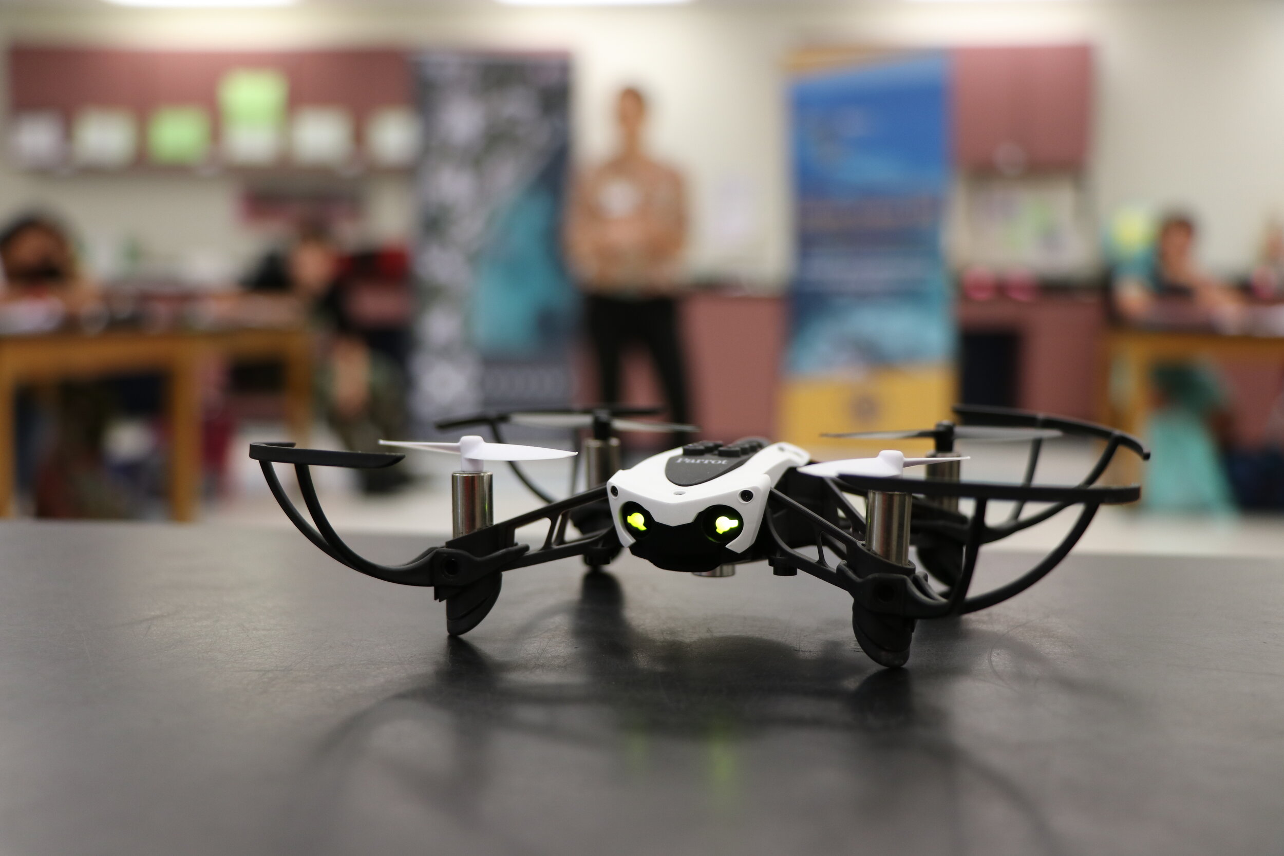 Flying over a model coastal town they built themselves (with help from their stellar science teacher, Ms. Kay Borglum), students captured drone imagery from before and after a hypothetical natural disaster to learn more about how drones can be used in disaster preparation, management and recovery. The students’ interactive model was built from recycled materials, and designed to transform from a pre-disaster to a post-disaster scene.
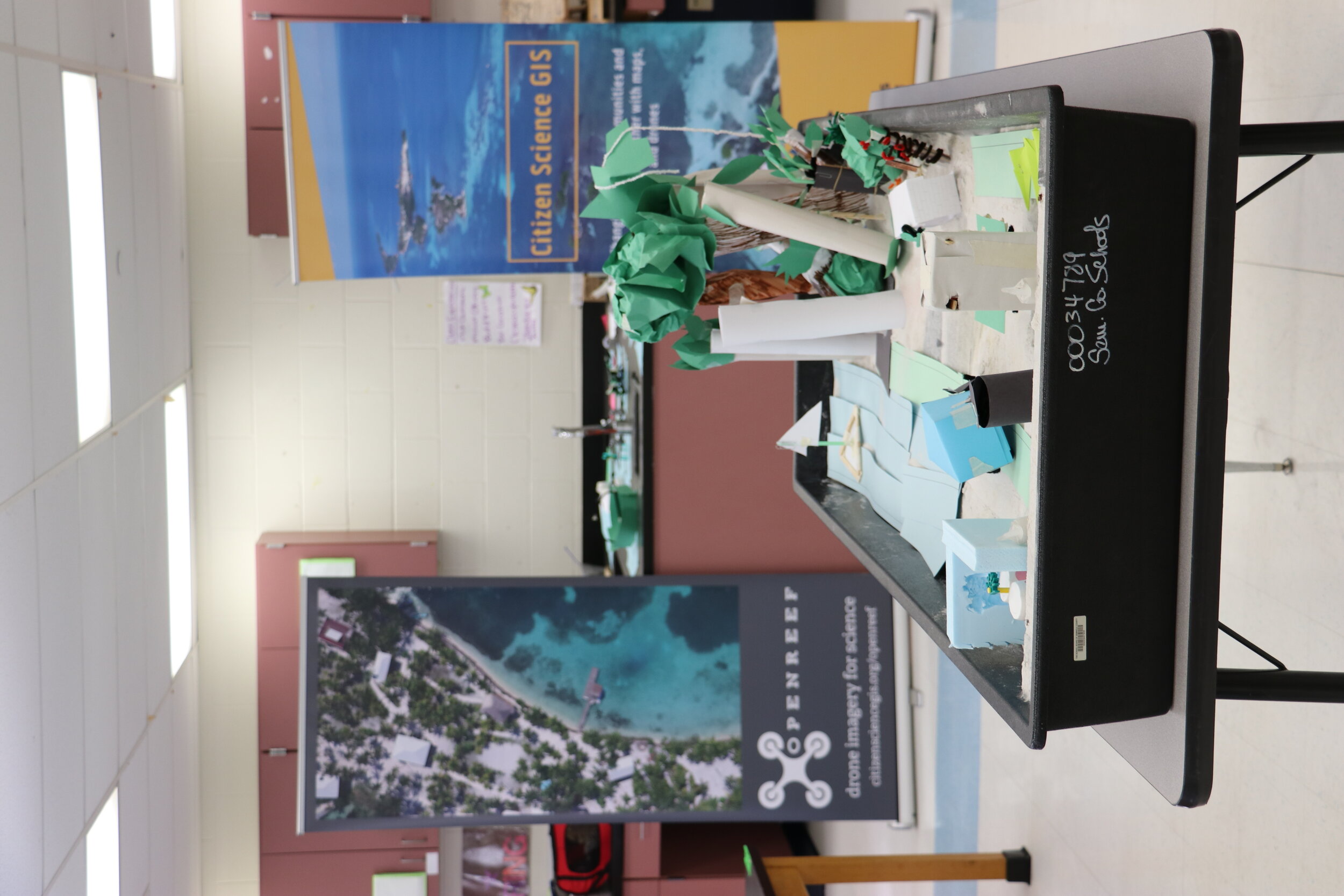 The miniature landscape was thoughtfully crafted to represent both natural and man-made environments, Ms. Borglum’s class focused their lesson on the disaster’s effects on living organisms. The post-disaster scene was riddled with downed trees, impassible roads and compromised buildings, including an oil refinery that could cause harmful pollutants to leak into the environment. Ms. Borglum’s students explained that the destructive scene represented areas of potential vulnerability, and flying the drone overhead would quickly provide important information about the condition of the community following a disaster.In this timely lesson students flew a Parrot Mambo mini-drone over the model with a tablet controller, using the FreeFlight Mini app. As the students flew, they took pictures of the model below to simulate the nearly instantaneous documentation capabilities of a drone in an actual disaster.
"We are very excited about our ongoing Citizen Science GIS (UCF) partnership project with our students. Our Sanford Middle School 8th graders' experience in actually flying and navigating a drone for the first time brought a new excitement to our science lab. Our math, science, technology magnet is a perfect match for this one of a kind real-world research experience. As a district, our SCPS graduates will have both a broad understanding of careers and a strong base of exploration of technology interests to have a clear plan for their college and job future."--Kay Borglum, MS (8th Grade Life Science Teacher, Sanford Middle School).
The students are now in the process of analyzing the imagery to assess disaster impacts to their simulated coastal community and talk through real-life applications for drone imagery. Ms. Borglum’s sharp eighth-graders earned their wings and learned how drones can quickly provide an eye in the sky, to plan for, monitor and mitigate disasters.Sanford Middle School was one of the first stops on the new “Maps, Apps, and Drones Tour” led by Citizen Science GIS. If you are involved with a K-12 school in Central Florida, please consider contacting us to see if we can visit your school for this exciting, hands-on science and technology event. Contact us at partner@citizensciencegis.org if you would like to join the tour.Written by UCF Postdoc, Hannah Torres and UCF Sociology PhD student, Lain Graham