
 On Tuesday, March 27th, 2018 as part of the free maps, apps, and drones tour with Citizen Science GIS, sixty-five 4th and 5th graders took part in the drone mapping activity. This fun, hands-on activity was designed to put students in the pilot seat, having them fly the drone over the mini-landscape to collect aerial imagery. This activity encourages peer-to-peer learning and challenges students to think through model construction, flight planning, logistics and image analysis.
Maps, Apps and Drones Tour Stop: Mount Dora Christian Academy
Mount Dora Christian Academy's 4th and 5th grader's built a model coastal community, repurposing common materials like cardboard boxes, popsicle sticks, and straws. Ms. Laurel Steele's 5th-grade class thoughtfully constructed the town for our coastal mapping drone activity, students collected pre-and-post-disaster imagery of their town with a Parrot Mambo mini-drone. This model included wonderful details such as surfers on the beach, parking spaces in town, and they even thought to put in lamp posts, roads and a strip mall with a Starbucks and a Chick-fil-a!On Tuesday, March 27th, 2018 as part of the free maps, apps, and drones tour with Citizen Science GIS, sixty-five 4th and 5th graders took part in the drone mapping activity. This fun, hands-on activity was designed to put students in the pilot seat, having them fly the drone over the mini-landscape to collect aerial imagery. This activity encourages peer-to-peer learning and challenges students to think through model construction, flight planning, logistics and image analysis.
On Tuesday, March 27th, 2018 as part of the free maps, apps, and drones tour with Citizen Science GIS, sixty-five 4th and 5th graders took part in the drone mapping activity. This fun, hands-on activity was designed to put students in the pilot seat, having them fly the drone over the mini-landscape to collect aerial imagery. This activity encourages peer-to-peer learning and challenges students to think through model construction, flight planning, logistics and image analysis.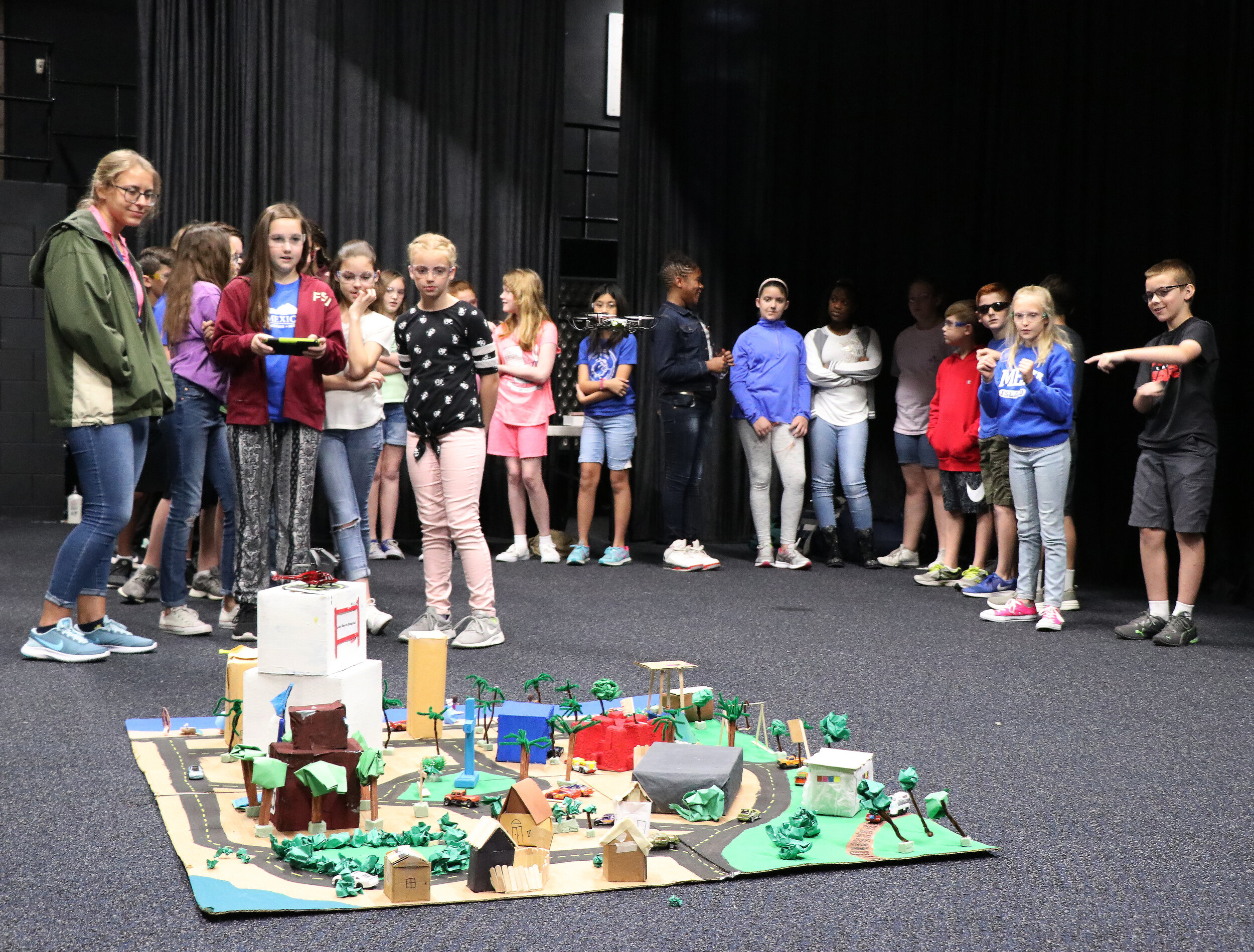
These 4th and 5th graders were fully engaged in the presentation, where they learned about drones and GIS and how these tools can be used to in natural disasters and other situations as a low-cost, time-sensitive solution to satellite imagery. Based on correct answers from GIS and drone-related questions a student was selected to be the hurricane that came through and (carefully) devastated the town. Ms. Steele’s class set the bar with the creation of their detailed townscape, their model city was thoughtfully crafted and represented notable landmarks within the Mount Dora area.

The Citizen Science GIS team engaged students in a critical discussion of the differences between satellite and drone imagery, and the many uses of drone technology to address real-world problems such as natural disasters. With the millions affected in Florida, Texas and the Caribbean by hurricanes, this proved to be a relatable exercise in how drone imagery can be used to quickly and efficiently provide a bird’s eye view to assess the disaster’s impacts on the landscape. The day was finalized with questions relating to the noticeable differences from the pre-to-post-disaster landscape and how students might use drones in other areas of interest.
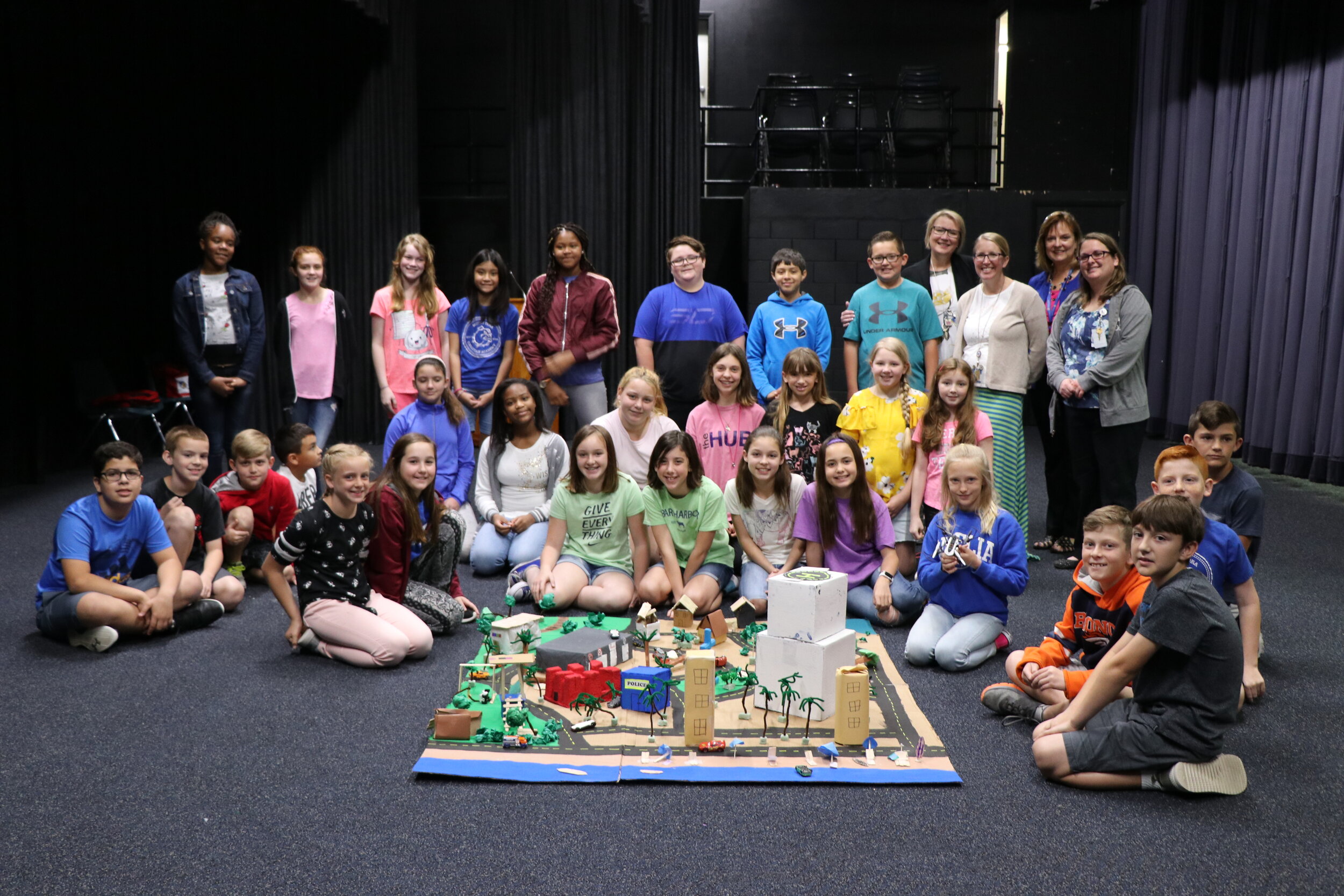
Mount Dora Christian Academy was one of the many stops on the Maps, Apps, and Drones Tour scheduled this year. If you are interested in having the Citizen Science GIS team bring this fun and engaging curriculum to your school, please contact us! Email us at partner@citizensciencegis.org if you want your school to experience the fun and creativity!