
Supporting Science’s Next Generation at UCF GIS Day 2017 with Citizen Science GIS & Esri's Education Manager, Dr. Joseph Kerski

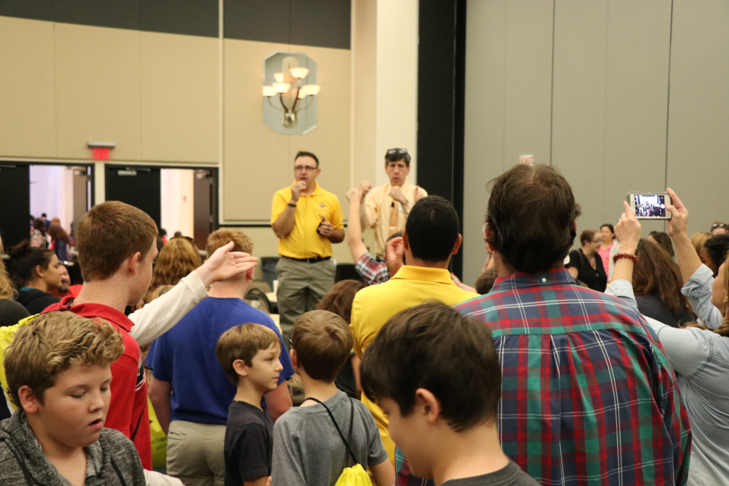
Written by UCF Sociology and GIS Ph.D. Student, Lain Graham:GIS Day at UCF on November 14 and 15 gave us all the geotingles!! A term coined by the one and only, Dr. Joseph Kerski, Education Manager at Esri and keynote speaker at UCF’s 2017 GIS Day. We were delighted to have Dr. Kerski for a very special GIS Day at the University of Central Florida. This was the first GIS Day hosted by UCF’s Sociology Department and the Citizen Science GIS team, and the event did not disappoint! We had about 350, K-12 students, homeschoolers, teachers, parents and volunteers at the hands-on, free, educational event on November 15th! Check out the next generation of science and their reactions to GIS Day at UCF in the short video link below![embed]https://m.youtube.com/watch?feature=youtu.be&v=ldtaCrDPQbM[/embed]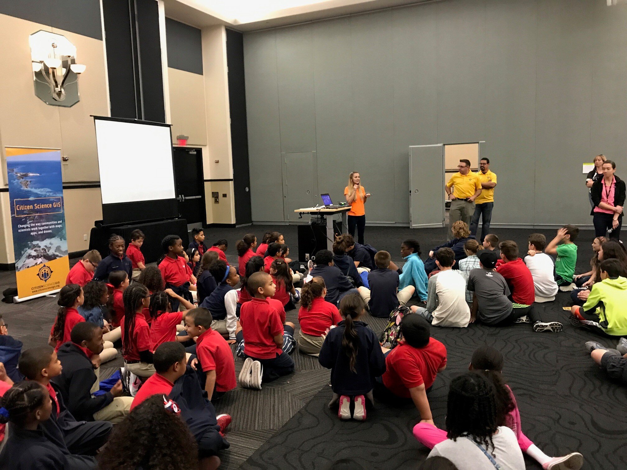 The event was led by Dr. Timothy Hawthorne, Assistant Professor of GIS in the Sociology Department and Ph.D. student Lain Graham. We had 14 interdisciplinary volunteers representing fields across UCF’s campus. Held in Pegasus Grand Ballroom in the Student Union, we had eight interactive mapping stations, two drone obstacle courses, two coastal disaster drone mapping station and four interactive digital mapping stations.Watch below to see students flying mini-drones over a model of a coastal town![embed]https://m.youtube.com/watch?feature=youtu.be&v=-0KAIZwVqTc[/embed]Our exciting, hands-on activities introduced science's next generation to GIS, maps, apps and drones! Through experience students learned how to pilot Parrot Mambo mini-drones, flying them over coastal and town models to simulate drone mapping pre-and-post natural disaster.
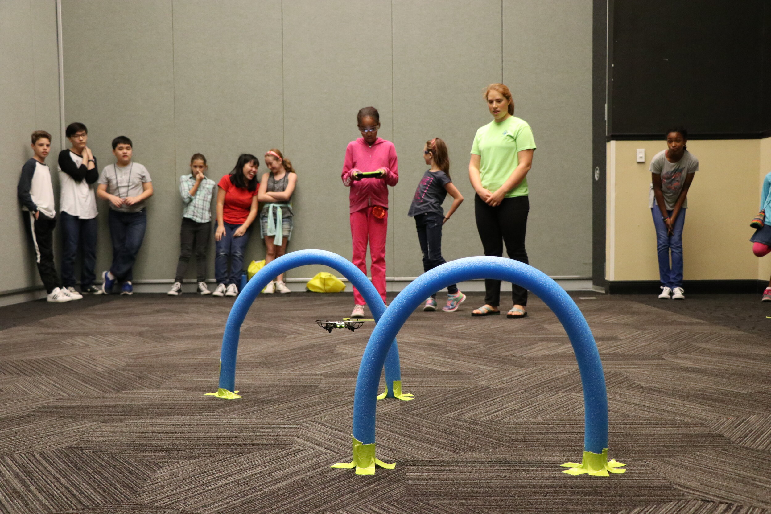 Drones are an incredibly time and cost efficient means by which to acquire aerial imagery to establish baseline data before a disaster strikes, and a means of comparison after a disaster has struck. Drone technology also allows for a near instantaneous aerial perspective which can be crucial to emergency management and decision makers in the midst of a disaster. The coastal drone mapping activity simulates real work that our team does with DJI Phantom 4 quadcopters in the field.
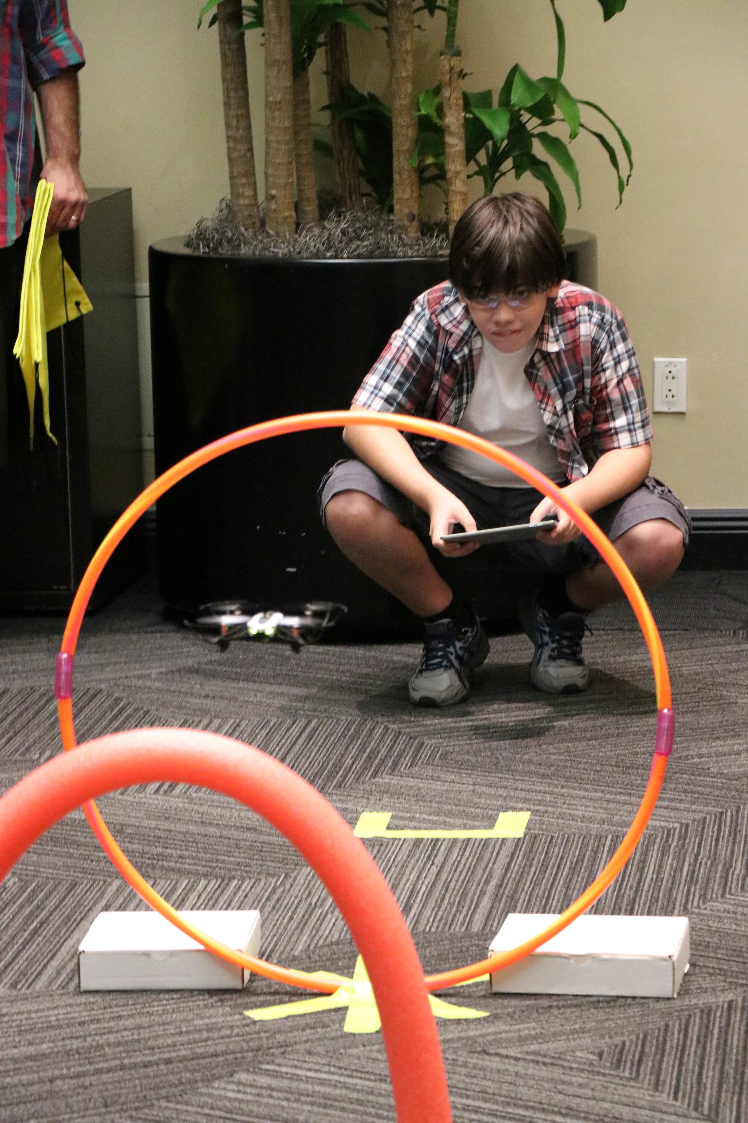 The next drone activity is a challenge of the heart and the mind! Just kidding, it is not that intense, but it sure is fun!
 This timed obstacle course challenges young pilots as they attempt to navigate the mini-drones through a series of obstacles without crashing to end on the landing pad at the end of the course, the current record holder is our own master drone pilot, Sociology M.A. student Nicholas Altizer, at a swift 15 seconds.
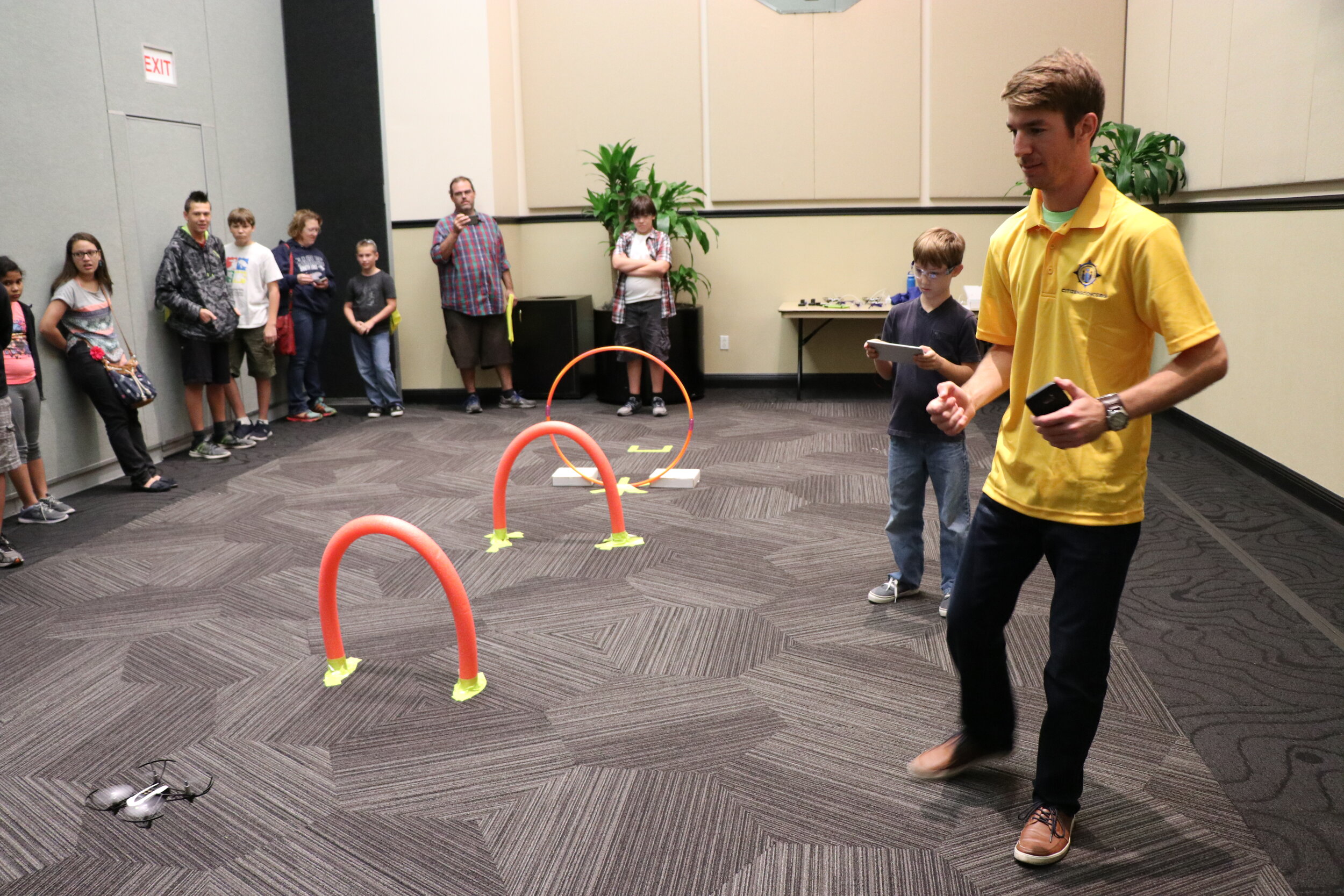 The next activity had students participate in a crowd-sourced mapping exercise created by the Citizen Science GIS team called “Sustain Our Schools Florida.” The exercise asks students to map current and future locations on their school grounds that have (or could have) sustainable features (such as recycling bins, composting piles, school gardens, alternative energy sources, and the like).You can add to the map with your students by clicking on the school house picture below! Join the power of the crowd through mapping for sustainability in Florida!
 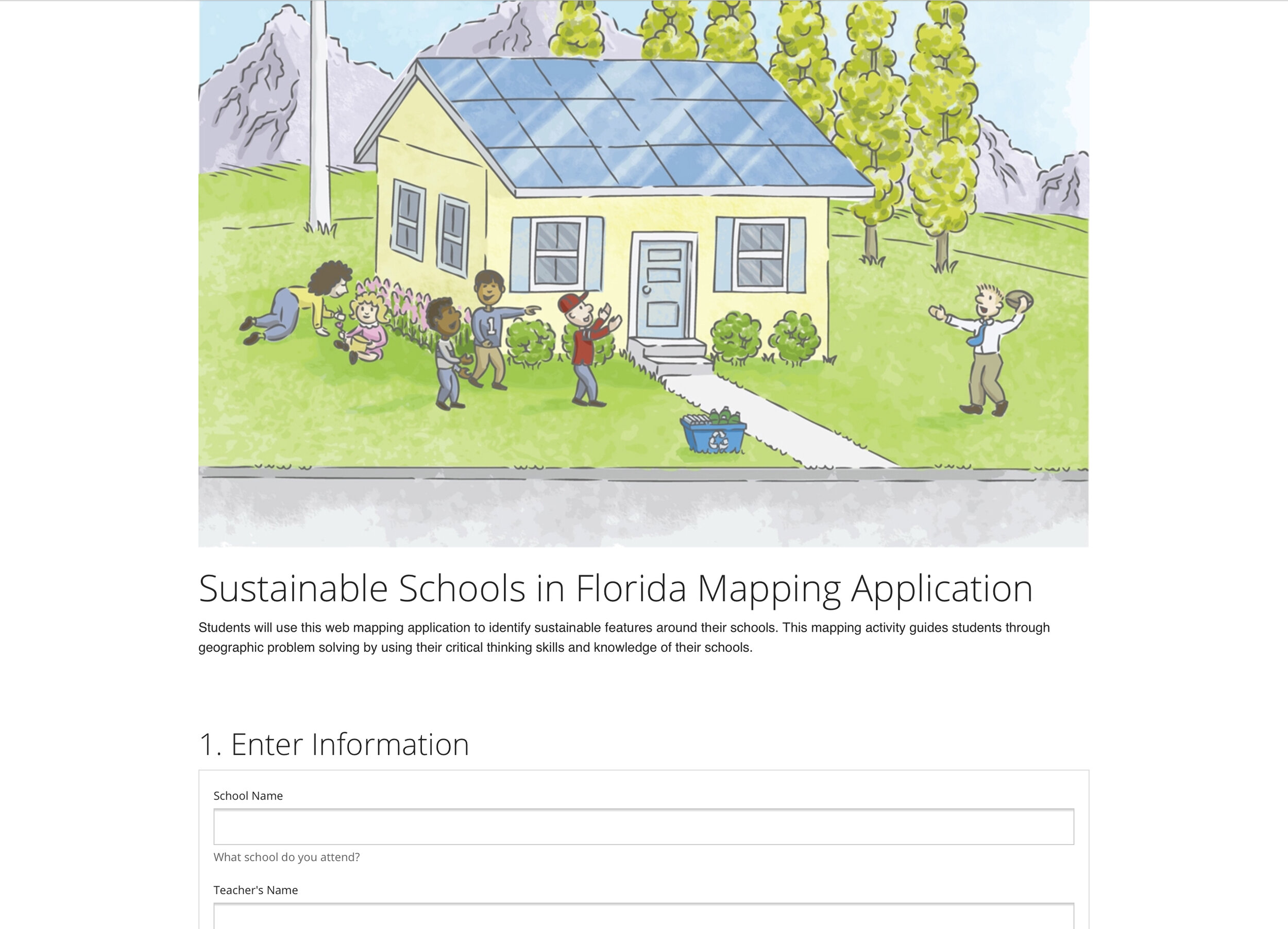 The final GIS Day activity is an incredible interactive migration map. This activity was led by Dr. Joseph Kerski of Esri. This interactive web map can be found on Esri’s website at http://coolmaps.esri.com/Migration/Trends/.
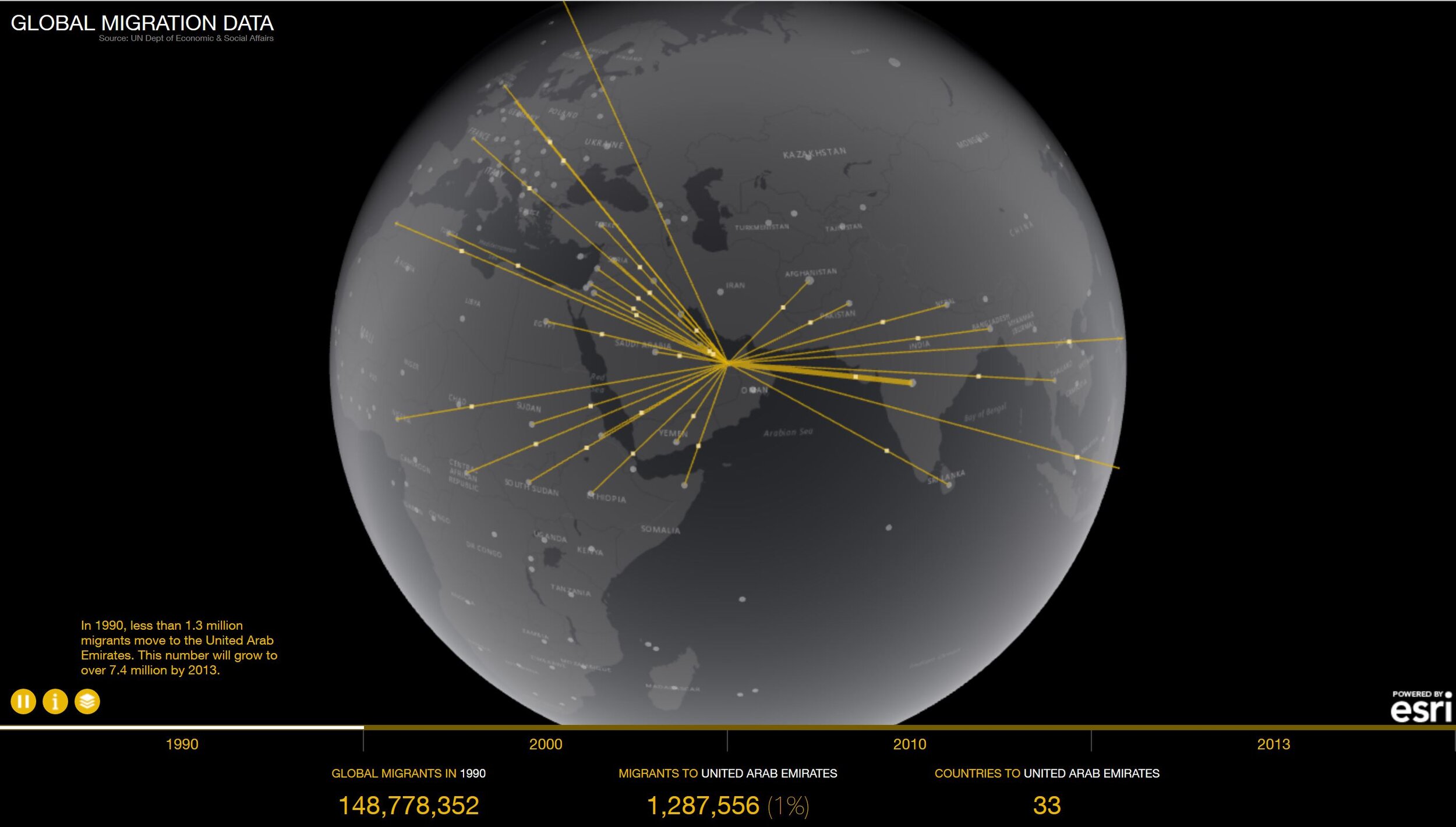 The Global trends in Migration map displays estimates of the number of international migrants by destination and origin. “This dataset contains time-series of estimates and projections of the number of international migrants in the 232 countries or areas for the years 1990, 2000, 2010 and 2013” (Anon. n.d. “Global Migration.” Retrieved November 22, 2017 (http://coolmaps.esri.com/Migration/Trends/).
 Thanks to all that came out to volunteer and participate! We are just getting started! A special thanks to our amazing, maptastic, keynote speaker, Dr. Joseph Kerski of Esri. Check out Esri’s awesome education blog, featuring GIS Day activities from around the world! https://community.esri.com/community/education/blog/2017/11/22/gis-day-2017-celebrating-people-and-projects-that-are-making-a-positive-difference
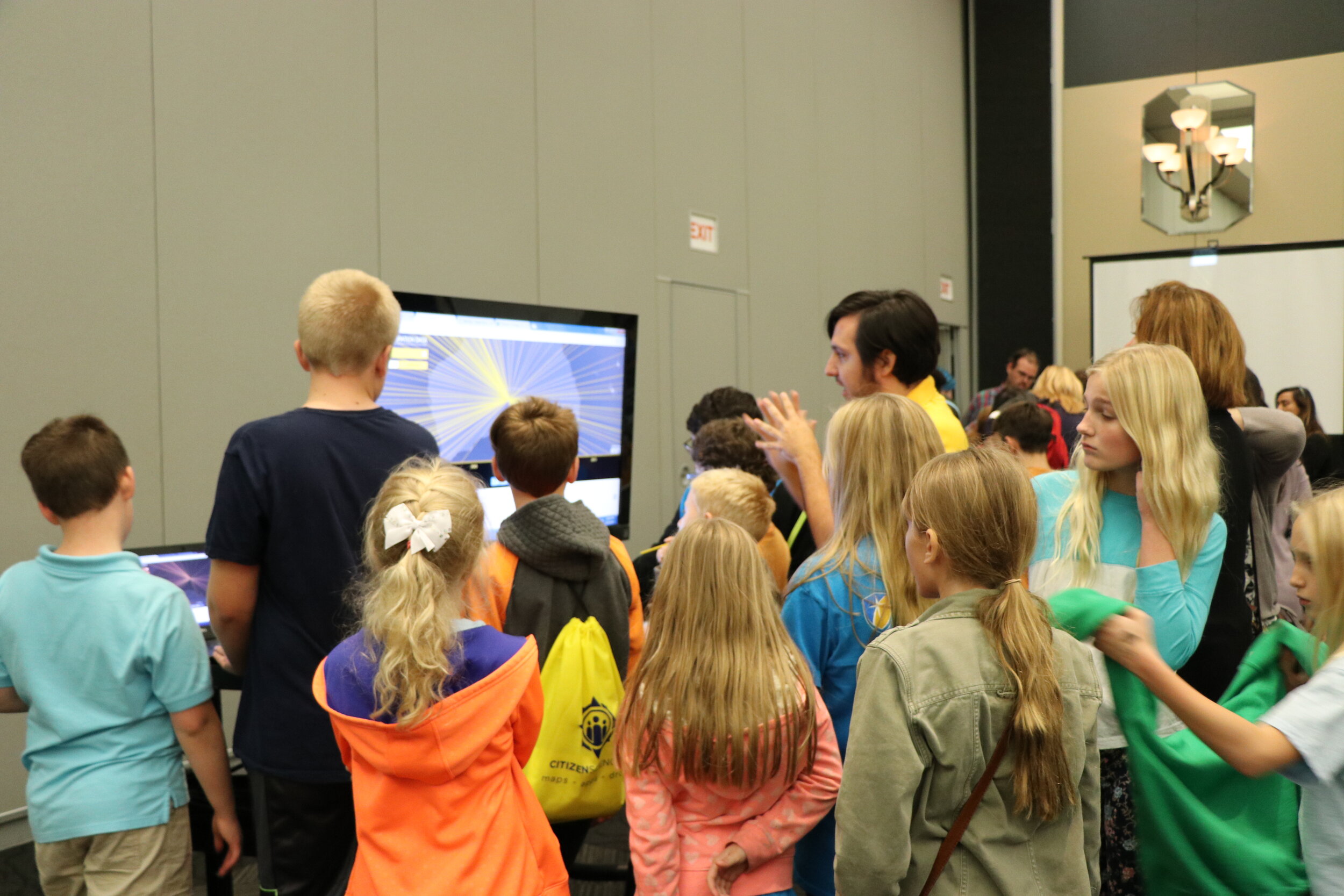
 These great activities are just a sample of our more in depth Maps, Apps and Drones tour, a free STEM educational program offered by Citizen Science GIS. You can learn more about (and sign up for) our school tour on our website at www.citizensciencegis.org/tour.