
A Summer of Citizen Science GIS in Hopkins, Belize and Orlando, FL
September 15, 2016Post written by Lain Graham, UCF Sociology PhD StudentOn August 5th 2016, our Citizen Science GIS NSF REU Site research team went LIVE with the presentation of our research and results to an in person audience as well as the Facebook world summarizing the summer of Citizen GIS in Orlando, FL (2 weeks) and Hopkins, Belize (5 weeks)! The three and a half hour symposium started at 8am Belizean time/10 am Eastern Standard and it took place at the University of Central Florida in the GIS space at Research Park. To see our archived presentation content visit our Citizen Science GIS Facebook page and to learn more check out our website at www.citizensciencegis.org.“I continue to be amazed at the creativity of our students and community members when they come together to examine complex social and environmental problems. Our international REU site is all about preparing students to be responsible, ethical, and commnity-minded scholars as they engage in international research and fieldwork. Our students worked side by side with Belizean residents, local leaders, and community groups to map local knowledge about marine debris, flooding, and tourism. Our community-based mapping methodology was the conduit for community stories to be told. Our team worked really hard to share the stories of the community in a way that prioritized their knowledge in the research process. We recognize working with a community abroad is a privilege. Community members know much more than we do about the issues most important to them. They don’t need researchers like us telling them the issues. They know the issues, but what’s often missing is communities don’t have their knowledge represented in data or on maps that can be shared to advocate for their positions in these discussions. Our students learn the complexities or working with communities rather working in communities through the international research experience. We’re just getting started, but a solid foundation has been built for continued collaborative success in the near future. We’re heading back in late October to continue the work and to train residents more on using the mapping applications to collect data as citizen scientists. That’s exciting! Local residents in Belize using technology to share their stories, while mapping for change,” said Dr. Timothy L. Hawthorne, principal investigator of the Citizen Science GIS REU Site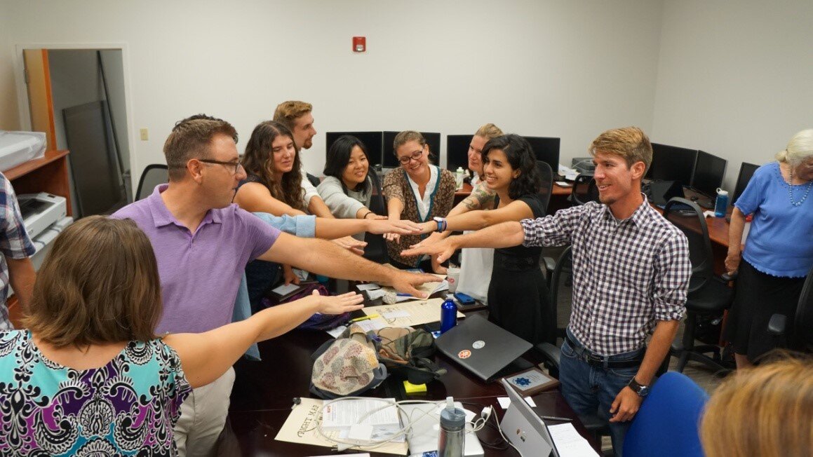 Figure 1: The group coming together one last time after the presentationsBoth the Marine Debris and Flooding teams (pictured below) recognize that this summer was just the start. This was the first of a three year project and we are excited to see how Hopkins utilizes and expands upon these data. We look forward to returning to Hopkins in the fall to resume data collection and to see the results of Village Council initiated community improvement projects, including a trip from October 23-November 3, 2016. With future work and with our data and maps showing concentrations of debris and areas of poor drainage, time and energy can be focused on areas that will have the greatest impact for the community.
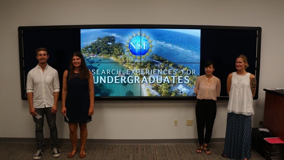 Figure 2: Marine Debris track: (from left) Caleb Ball, Hannah Bonestroo, Saraneh Fitzgerald and Ashley Little in front of the interactive geovisualization wall in the UCF GIS space.
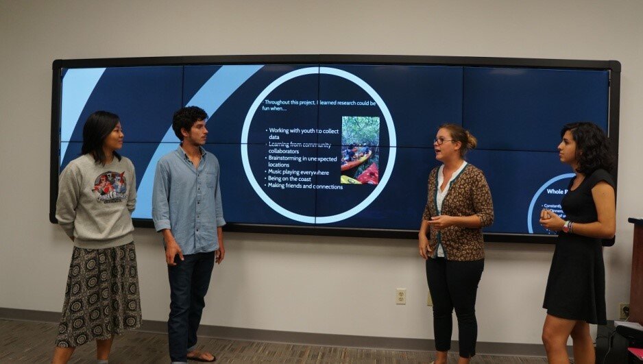 Figure 3: Flooding Management track: (from left) Sarah Kuo, Jake Wake, Amanda Ashby and Jasmine Perez
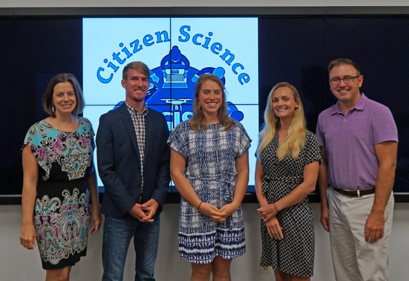 Figure 4: 2016 REU Staff (from left) Dr. Christy Visaggi, Co-PI: Nicholas Altizer, Program Assistant Coordinator; Christine Munisteri, Program Assistant Coordinator; Lain Graham, Senior Research Coordinator; Dr. Timothy Hawthorne, PI.It is our mission to ensure that our deliverables have been met to the Village Council and to the people of Hopkins as collaboratively agreed upon in our Memorandum of Understanding (MOU). The students spent seven weeks researching, constructing, testing, collecting, analyzing and reporting on these data which enables the swift delivery of these items as promised. Our maps are now published and openly available online at www.citizensciencegis.org.Follow the links below to review the results for both tracks:[embed]http://www.citizensciencegis.org/ucf-reu-site/broader-impacts/debris-research/[/embed][embed]http://www.citizensciencegis.org/ucf-reu-site/broader-impacts/flooding-research/[/embed]In addition to the data mentioned above, our team also created new, high resolution base map imagery for the Village of Hopkins with several Phantom 3 drone quadcopters. These drones captured pictures in 10 second intervals; these images were collected at an altitude of 350 meters and were stitched together with Pix4D to provide high quality baseline imagery to Hopkins where it did not exist before. This imagery allowed us to map and measure the coast, roads, structures, culverts and identify bodies of water and its subsequent uses are endless.Check out the new Hopkins imagery on a new tourism map also created for Hopkins by Citizen Science GIS staff members at http://ucfonline.maps.arcgis.com/apps/PublicInformation/index.html?appid=fd939a3a4f23446495478ab1b6141c99
 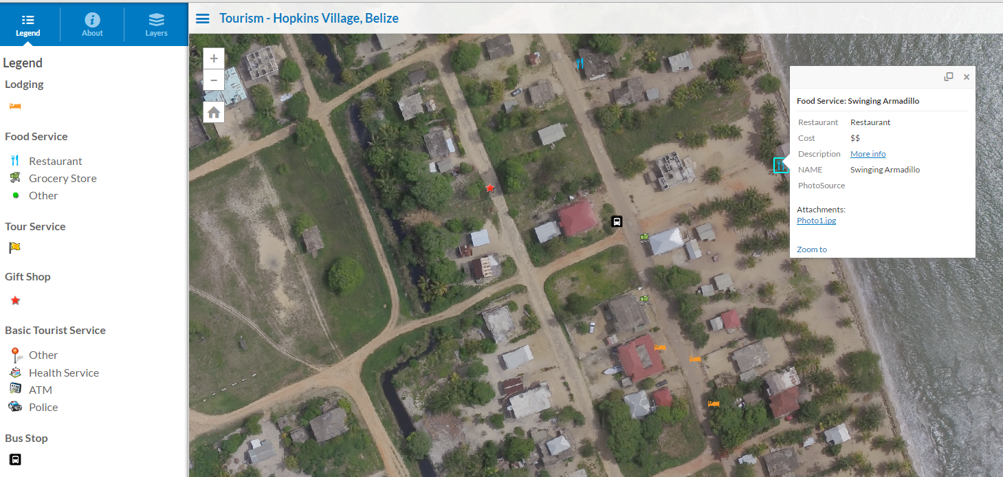 We are pleased for all that was accomplished this summer, but we are well aware that this community geography and citizen science journey has merely begun, it appears that we are well on our way to providing solid, open source data that can be utilized and applied by community members, business owners, academics and GIS enthusiasts alike. We are so excited to return to Belize, to see our friends in Hopkins and continue with this collaborative research.