
A Successful Free Workshop to Educate Florida Teachers on GIS and Drones led by Citizen Science GIS
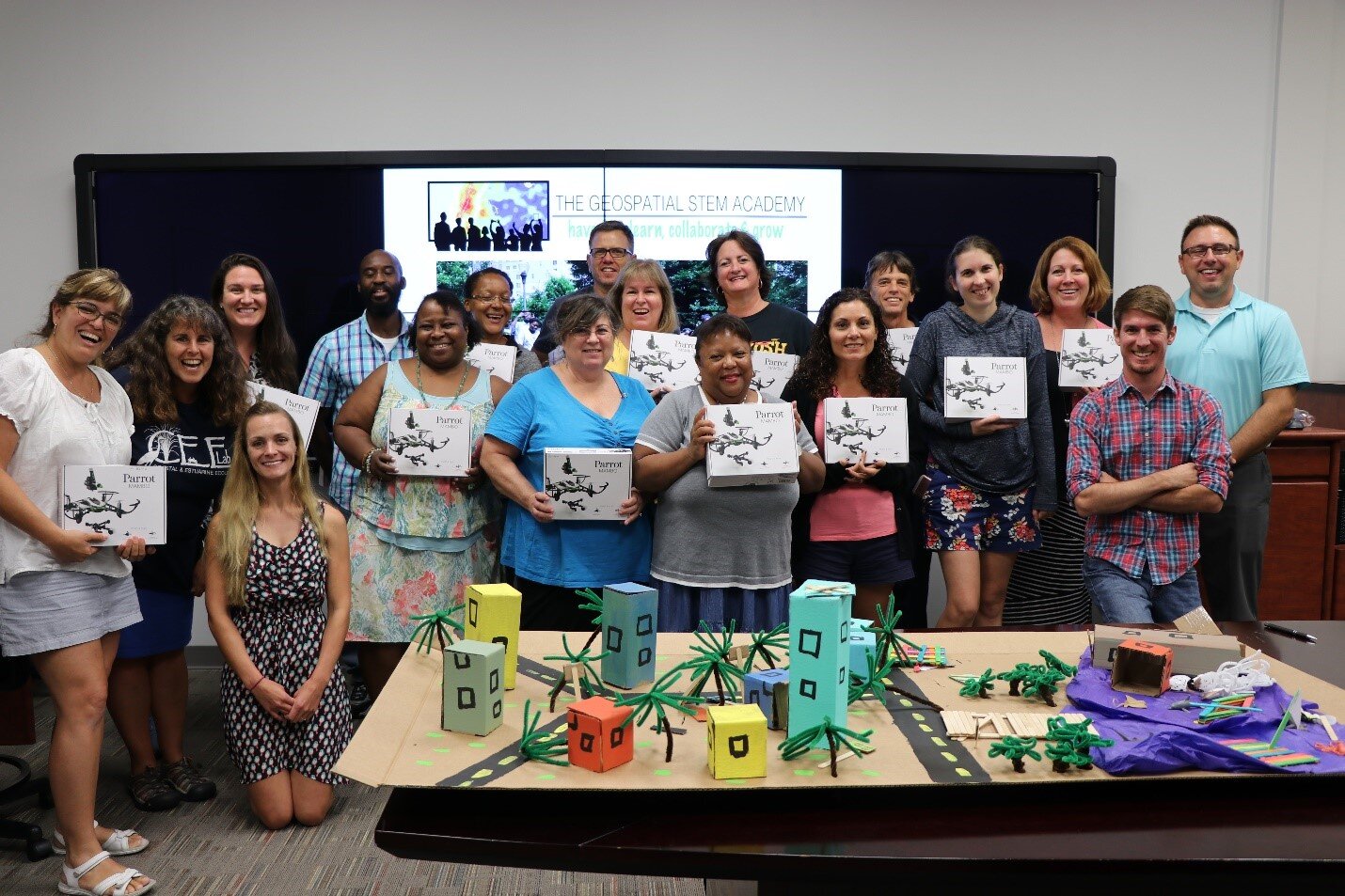
Written by Nicholas Altizer and Lain GrahamOn June 6, 2017, the University of Central Florida, including Citizen Science GIS and the UCF NSF CNH grant team, led a free teacher workshop to educate Florida middle school teachers on geospatial technologies and how they can be used in primary and secondary education. Led by Dr. Timothy Hawthorne and Dr. Linda Walters, the workshop included 14 teachers from the greater Orlando region and South Florida. The day was packed with informational sessions ranging from interactive sustainability activities to drone flying to coastal themed yoga. One of the first activities involved current work at the Indian River Lagoon in which individuals use an online mapping application to denote regions in which they are emotionally invested. Teachers had an opportunity to utilize the application and map their own sense of place before seeing points other teachers had placed on the map and what they had to say about that location. After taking part in the exercise teachers discussed varying ways they could apply the same principles to educational activities for their students.After a short break the teachers got a chance to try their hands at using a sustainability mapping application which was created for students to input data on sustainable features, such as recycling bins and solar energy sources, at their school. Teachers talked about ways they could use the activity to engage students and educate them on geospatial technologies and their uses. One such idea involved using Barbie dolls to simulate a search and rescue operation with drones. The accompanying lesson plan is connected to Florida standards and allows teachers to adjust if needed while ensuring education outcomes are in line with Florida educational goals.
 Looming thunderstorms could not quell the excitement for the next segment… drones! Drones have become a popular tool for professionals and novices alike; we wanted to capitalize on this fascination, and use it as way to get kids (and their teachers) excited about drone applications in the classroom.
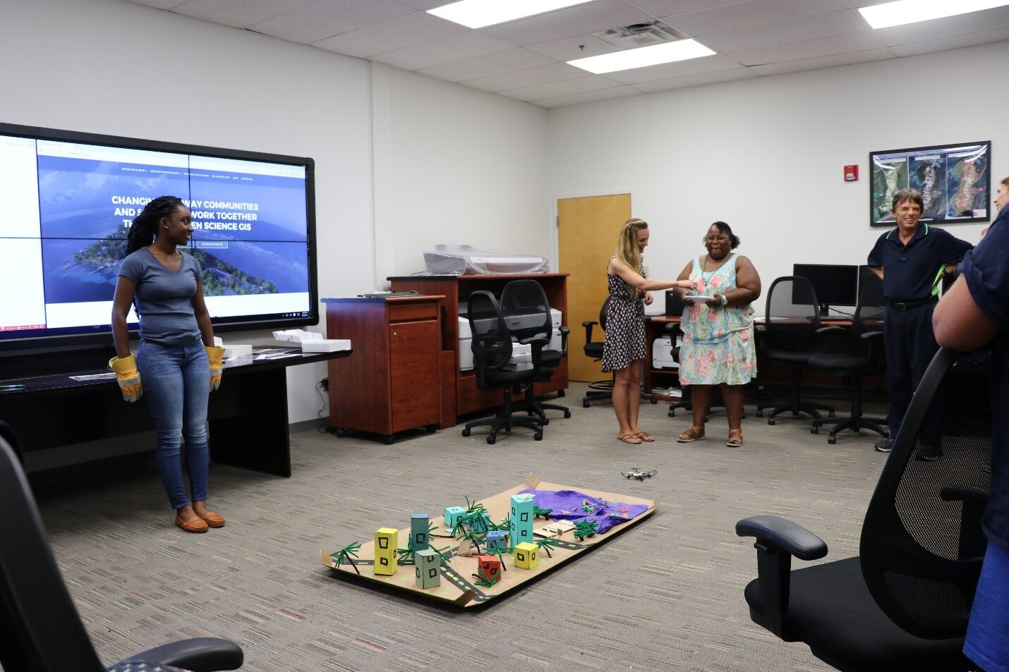
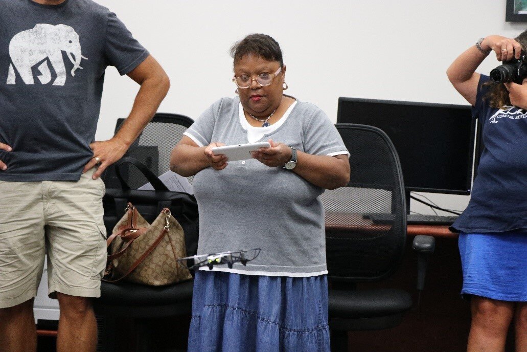 The Drone Mapping Coastal Disasters lesson plan was designed to get kids engaged in hands on, critical thinking. The central question is how can drone technology and geographic information systems (GIS) identity and mitigate the effects of coastal disasters?Teachers learned about the construction of pre-and-post-disaster model landscape, they each flew over the model with a mini drone and finally, the team collectively reviewed and interpreted the pre-and-post-disaster imagery collected by the drone. The enthusiasm was incredible! The teachers were brimming with ideas on how they could build on the activity in their classrooms.In reflecting on the day’s events a few summative quotes resonated with the group, “For me it is workable within the curriculum, I can envision it with the kids and what we are doing” (Nicole Spoin, Middle school teacher).“Using technology as a tool to bring a connection between science and society, because a lot of students need to be able to see the connections to make everything relevant to them” (Paul Walters, high school teacher).The teacher workshop embodied our mission to create fun, collaborative activities that are designed to expose students to a variety of interconnected lessons highlighting science, technology, engineering, arts, and math (STEAM).